


DELMARVA -- High pressure will shift offshore early this morning, allowing a warm front to lift northward west of Delmarva. The day will begin mostly sunny, with only some high cirrus clouds, but clouds will gradually lower and thicken through the afternoon. Southwesterly winds will bring warmer air into the region, pushing high temperatures into the mid to upper 60s across most of the peninsula—several degrees above the seasonal average.
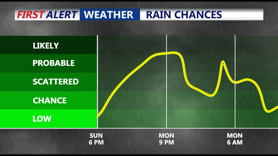
As sunset approaches, moisture will continue to increase, leading to a higher likelihood of scattered rain developing overnight. While rainfall is not expected to be heavy, periods of light to moderate rain may occur, driven by multiple upper-level disturbances. Our streak of days without measurable rainfall will likely come to an end, however this won't be a drought busting rain event. Totals will generally be between 0.25 inches to 0.60 inches into early Monday morning.

Expect 0.25"-0.60" of rain
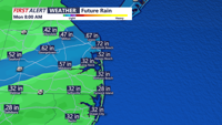
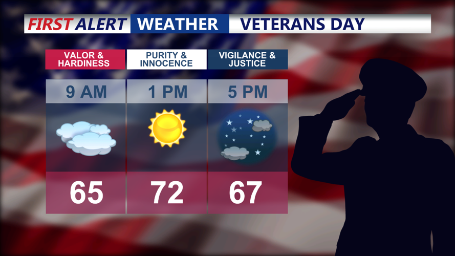
Veterans Day morning will begin with leftover rain showers tapering off from west to east as a cold front crosses the region. By the afternoon, skies will clear, leaving most areas dry with breezy conditions. High temperatures will range from the mid-60s to low 70s, offering one more mild day before cooler air arrives. Monday night will feature mostly clear skies, with lows dropping into the 40s thanks to drier air moving in, although breezy conditions may limit radiational cooling.

Sunny skies by the afternoon
A secondary cold front will move through the Mid-Atlantic on Tuesday, but with limited moisture in the atmosphere, it will pass through dry. Behind the front, cooler and drier air will settle in, resulting in a noticeable drop in temperatures. Highs on Tuesday will only reach the upper 50s to around 60 degrees, despite mostly sunny skies. Dew points will also drop, creating a crisp, fall-like feel to the air.
High pressure will dominate Tuesday night into Wednesday, keeping conditions dry and seasonably cool. Overnight lows will dip into the 30s and 40s, and Wednesday’s highs will reach the mid-50s to low 60s under sunny skies.
By Wednesday night, an upper-level trough and an associated cold front will approach the region. Rain showers are likely to develop late Wednesday into Thursday, with the highest chance of precipitation on Thursday (40% chance). Temperatures on Thursday will hover in the low 60s before cooler and drier air returns behind the front late Thursday night.
As the front clears, high pressure will rebuild over the area by late Friday, bringing another stretch of dry and sunny weather. Temperatures will remain seasonably cool heading into next weekend, with highs in the upper 50s to low 60s and lows in the 40s.
