


DELMARVA - Beachgoers in Sussex County can expect a change in weather as the weekend approaches, with increasing clouds and the possibility of showers from late Thursday night into Saturday morning.
Thursday night will remain mostly dry across the area, thanks to high pressure offshore and stable air suppressing major activity. However, a coastal low developing in the Carolinas and a cold front inching eastward from the Great Lakes may begin to influence conditions. While the immediate threat of rain is low tonight, some showers may sneak into southern Delaware overnight as the coastal low drifts north toward the Chesapeake Bay.
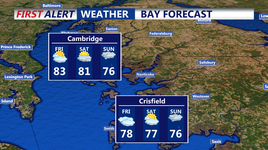
Friday brings unsettled conditions. While most of the morning may remain dry, showers are expected to move into the region by afternoon and evening. The coastal low will likely move out to sea Friday night, but with the cold front drawing closer from the west, the chance for rain increases. Precipitable water values—a measure of atmospheric moisture—will climb, signaling the potential for heavy downpours, especially inland. That said, a stray shower can’t be ruled out along the beaches.
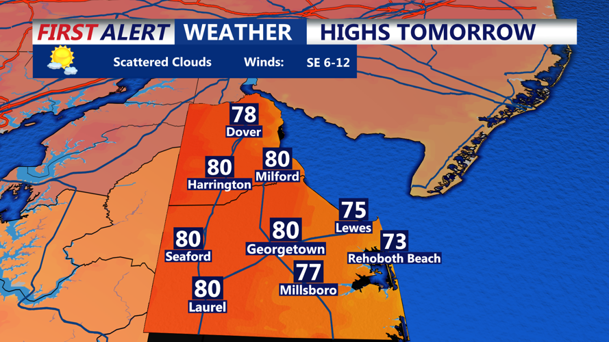
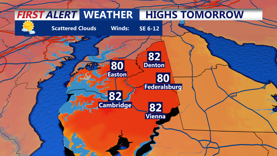
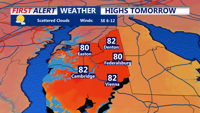
Temperatures on Friday will be warm but a touch cooler than Thursday, reaching the mid-70s to mid-80s inland, with 70s expected along the coast. Humidity will remain noticeable, keeping the air sticky throughout the day and evening.
Saturday may bring more widespread rain and even a few thunderstorms. As the cold front finally gains enough upper-level support to push across the region, expect rain chances to rise, especially in the morning. Instability could support isolated thunderstorms, but severe weather is not anticipated. Still, brief heavy rainfall and some thunder could impact beachgoers and morning events.
Highs on Saturday are forecast to stay in the upper 60s to upper 70s, with the potential for some lower 80s across southern Delmarva before the front fully clears. Skies should begin to clear by late in the day, setting the stage for a drier Sunday.
Looking ahead, the weather remains active through early next week, with additional systems and chances for showers and storms. Stay tuned to local forecasts for updates.
