


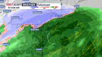

DELMARVA -- Low pressure remains in control over the Middle Atlantic region tonight, keeping conditions raw and breezy across Delmarva. Light rain will gradually diminish from northwest to southeast as the evening progresses. Winds will stay elevated, with northwesterly gusts adding to the raw feel of the night. Cloud cover will persist, preventing temperatures from dropping too low. Lows will hold steady in the mid to upper 30s, with most areas staying above freezing.
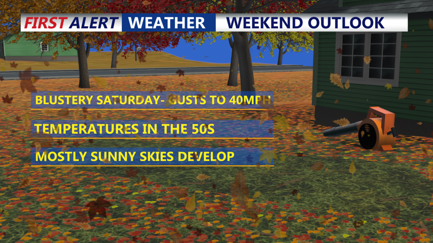
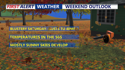
As the low-pressure system moves into the Canadian Maritimes, conditions will improve across Delmarva. Expect partial sunshine, especially in southern areas, though the day will remain brisk with northwesterly winds at 15-20 mph, gusting up to 30 mph. Highs will rebound about 10 degrees from Friday’s chilly readings, reaching the low to mid-50s. However, the gusty winds will make it feel cooler than the thermometer suggests.

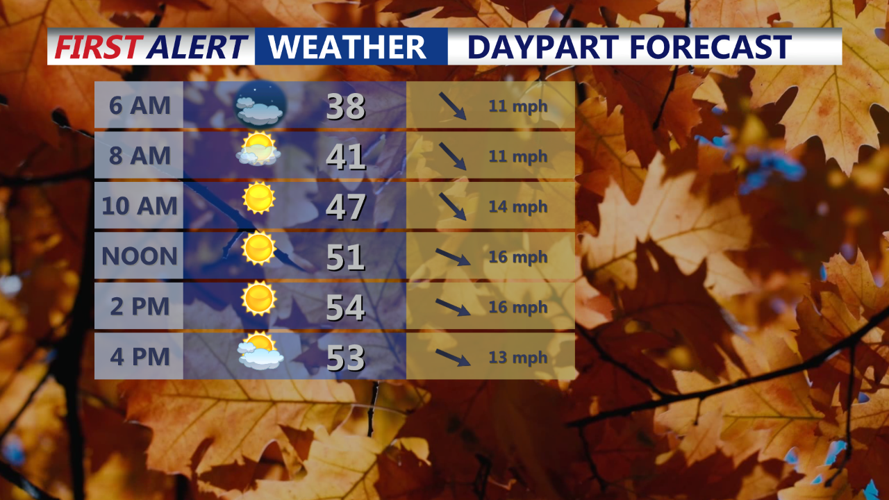
Saturday Day Planner
A quieter weather pattern sets up Saturday night through Monday, as weak high pressure builds over the region. Skies will be partly to mostly clear during this stretch, with dry weather expected. Sunday night’s lows will dip into the upper 30s to low 40s in urban and coastal areas, with cooler spots in the mid-30s. Daytime highs will climb into the mid to upper 50s both Sunday and Monday, offering a pleasant start to the workweek. Clouds may begin to increase late Monday ahead of an approaching cold front.
A cold front will move through Monday night, ushering in a cooler air mass. Showers are possible Monday night, primarily in northern and western areas, but temperatures will remain too mild for any wintry precipitation. Behind the front, high pressure will bring dry weather Tuesday and Wednesday. Highs will remain in the low 50s on Tuesday before dropping slightly below average by Wednesday, with highs in the upper 40s to low 50s.
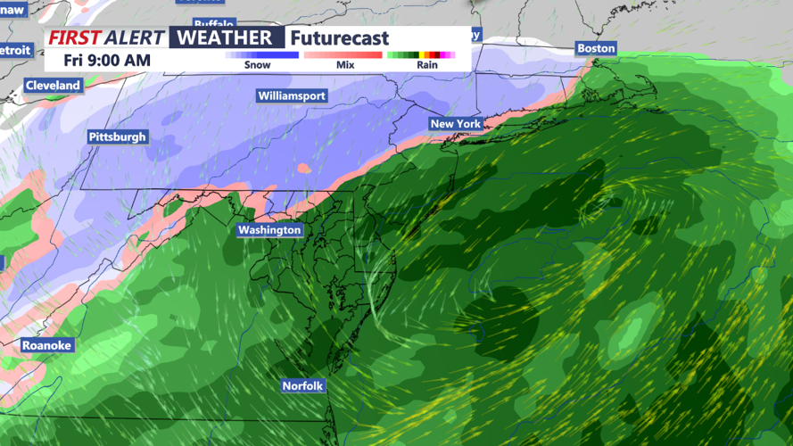
A developing low-pressure system may impact Delmarva around the Thanksgiving holiday. While details remain uncertain, the system could bring widespread rain on Thursday and Thursday night, with some snow possible farther north in the southern Poconos and northern New Jersey. The low is expected to strengthen as it moves offshore, so precipitation may linger into Friday. Stay tuned for updates as the forecast becomes clearer.

Storm System Thanksgiving into Black Friday
