


DELMARVA -- Rain will spread across Delmarva tonight, driven by an area of low pressure and an associated cold front. Precipitation is expected to end by daybreak, with rainfall totals ranging between 0.25 to 0.30 inches. Northwest winds behind the front will pick up early Thursday, with gusts approaching 20 mph. Overnight lows are expected to drop to the upper 30s.
High pressure will settle over southern Quebec on Thursday, bringing calmer and seasonable weather to the region. Mostly sunny skies and highs in the upper 40s are forecast, offering a brief respite before the next system arrives late Thursday night.

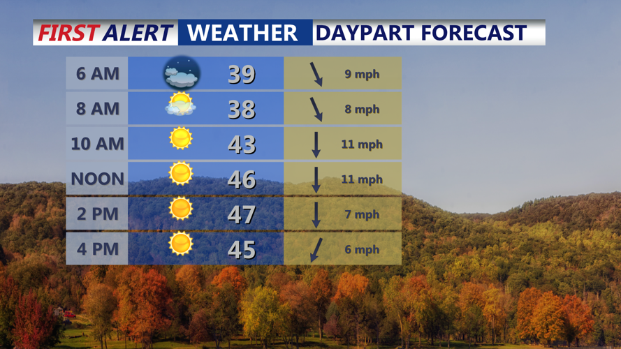
Sunshine and breezy conditions Thursday
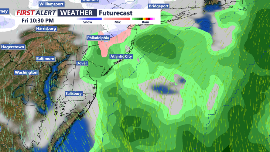
By Friday, attention shifts to a deepening low-pressure system moving across the southern Great Lakes. Light rain and snow are expected to develop as the system passes through Delmarva. A secondary low offshore could enhance precipitation, potentially creating a Norlun trough setup, though its exact impact remains uncertain. Right now the thinking is cloudy skies Friday, with a chance for rain/snow showers Friday evening.

Front and coastal low can bring a few light rain/snow showers Friday Night.
Precipitation is forecast to taper off early Saturday, leaving behind blustery and cold conditions. Highs on Saturday will only reach the mid-to-upper 30s.
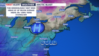
As the weekend progresses, an arctic high-pressure system will move in, bringing frigid temperatures. Sunday highs are expected to remain in the 20s, with some areas experiencing single-digit lows Sunday night.

Arctic high brings coldest airmass so far this season over the weekend.
Looking ahead, a new system could impact the region by Christmas Eve into Christmas Day. Early projections indicate a wintry mix transitioning to rain as temperatures gradually warm. While this does not appear to be a major storm, it could still disrupt holiday plans.