



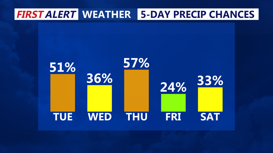
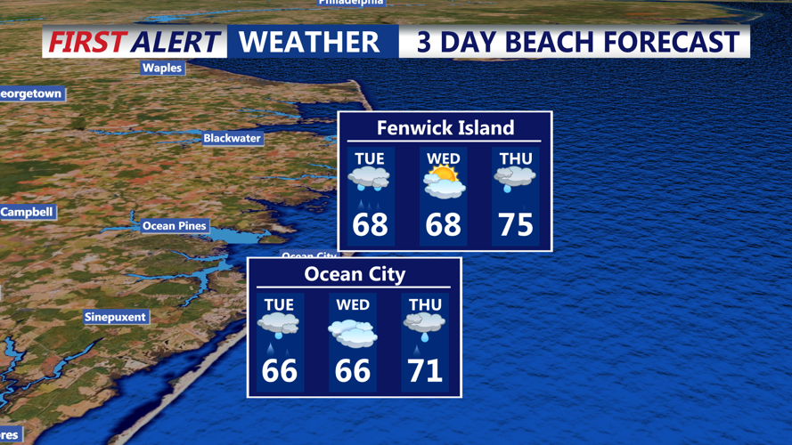
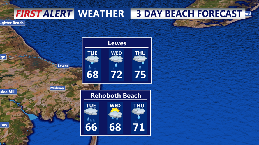

DELMARVA - The weather pattern for coastal Sussex County is turning increasingly unsettled, with multiple rounds of rain and thunderstorms expected from early Tuesday through early Thursday morning.
After a mostly dry but cloudy start to Monday evening, rain chances ramped up overnight—and the main event is unfolding now. Tuesday morning will feature scattered showers, but by Tuesday afternoon and night, a stronger surge of moisture and instability will lead to widespread rain and embedded thunderstorms, some of which may produce heavy downpours and localized flooding. Expect gusty winds, ponding on roads, and reduced visibility at times.
Rainfall totals from Tuesday into Wednesday morning could already approach 1 to 2 inches, with another round of showers and storms likely late Wednesday into early Thursday. By the time this system exits the region, some parts of the Delmarva coast could pick up over 3 inches of rainfall in total.
WHAT TO EXPECT???
Commuters: Allow extra time, especially during the Tuesday evening and Wednesday morning commutes, when rain could be at its heaviest.
Clothing tips: Waterproof outerwear is a must—wear boots or rain shoes, bring a sturdy umbrella, and consider a poncho for longer walks or time outdoors.
Coastal impacts: Minor flooding is possible in low-lying areas and spots with poor drainage. Keep an eye on tide levels and stormwater accumulation, particularly in flood-prone parts of Rehoboth, Bethany Beach, and Dewey Beach.
Thunderstorms: Although widespread severe weather isn’t expected, isolated rumbles of thunder and brief wind gusts are possible. Lightning is a hazard—seek shelter if you hear thunder.
After early Thursday, the system begins to move out, but lingering showers may stick around through the end of the week, so this wet pattern isn't over just yet.
