


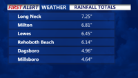


DELMARVA -- Record setting rainfall exits, while oppressive heat rolls back into the region. The rainfall over the last day and half has been impressive to say the least, over performing with five to seven inches across Sussex County.

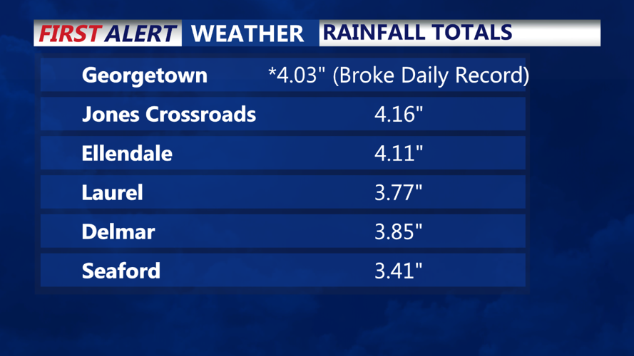
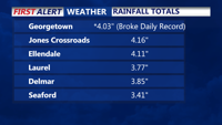
Georgetown broke a single day daily rainfall record of 4.03, the previous record was 3.41 inches in 2013.

This rainfall was spawned by a stalled out frontal boundary, an area of low pressure off the southeast coast, in addition plenty of moisture in the atmosphere with this humid airmass in place. Precipitable water content was very high for these storms to tap into.
Saturday night, as the downpours dissipate, will see partly cloudy skies. It will be very muggy and some fog will likely develop by overnight into early Sunday morning. A dense marine fog advisory is up until 12 p.m. Sunday.
The big story will be the heatwave that begins Sunday. A huge Bermuda high will funnel in stifling heat and humidity Sunday through Wednesday.
Sunday will be hot and humid with highs in the low to mid 90s, the heat index will range from 101 to 105 degrees. An isolated evening thunderstorm is possible, but most of the area will remain dry.
Monday will be more of the same oppressive, highs in the upper 90s with heat indices in the 103 to 108 range.
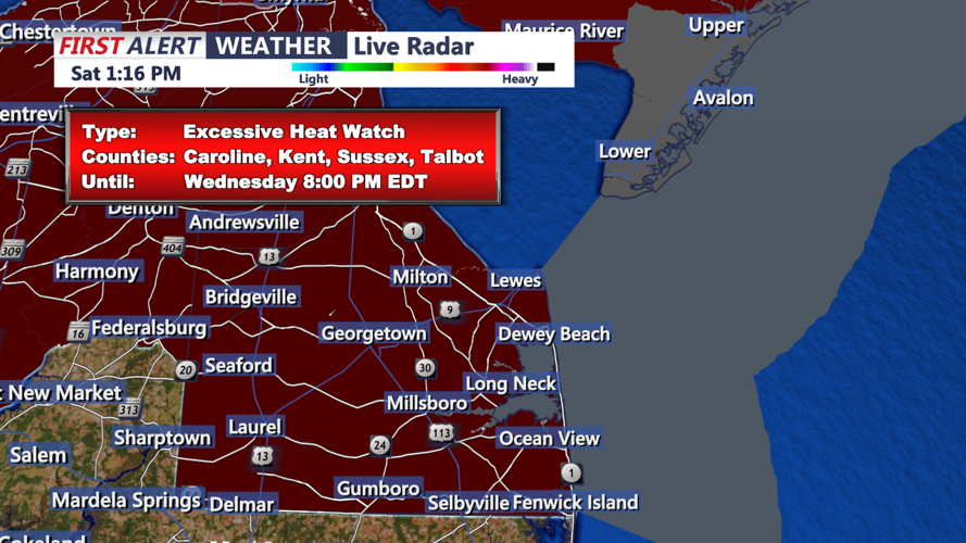
An Excessive Heat Watch is up from Tuesday morning to Wednesday evening.

This is when we expect the worst of the heat and humidity to arrive. Air temperatures Tuesday will approach the century mark while heat indices will be 105 to 111 degrees. In fact it may be just as hot and oppressive at the coast both Tuesday and Wednesday as it is for inland areas. A front will move through Thursday putting and an end to the heatwave as will see shower and storm chances increase on Thursday.
Be sure to stay hydrated, wear lose light fit clothing, limit time outdoors and remember never leave your kids or pets inside the car.
