


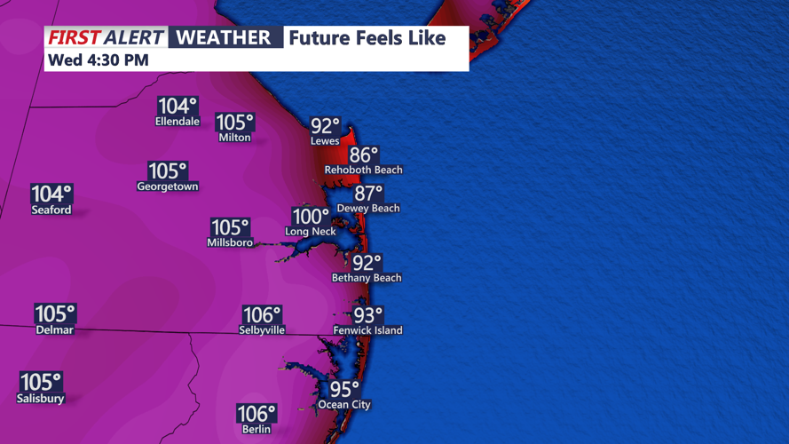


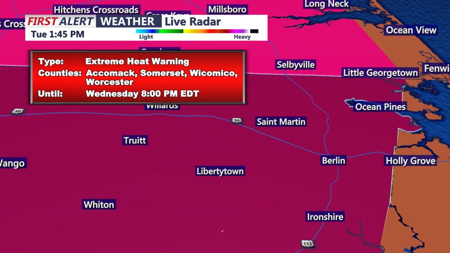


DELMARVA - A dangerous stretch of extreme heat continues early Wednesday in Sussex County, with high temperatures and humidity pushing heat index values near 100 degrees. However, forecasters say change is on the way by late Wednesday into early Friday.
Through the day Wednesday, oppressive conditions will persist across much of Delmarva. Temperatures will again soar into the 90s, with high humidity making it feel even hotter. Heat warnings remain in effect across most of the area, urging residents to limit outdoor activity, stay hydrated, and avoid leaving children or pets in parked vehicles.
By Wednesday evening, a shift begins. A cold front approaching from the north will increase chances for scattered showers and thunderstorms across the region. While a few stronger storms could bring gusty winds, the risk for widespread severe weather remains low.
Wednesday night will remain warm and muggy, with overnight lows only dipping into the 70s. But by Thursday, the cold front will push farther south, bringing a noticeable change in temperatures—especially for areas north of the front.
Highs on Thursday are expected to range from the upper 70s in northern zones to the low 90s in southern Sussex County. Humid conditions will linger in the south, where heat index values may again approach 100 degrees before the front fully moves through.
Scattered thunderstorms are possible again Thursday afternoon and evening as the front progresses through the region. Gusty winds and downpours are the primary concerns.
By early Friday, much of Sussex County will experience significant relief. Cloudy skies and an onshore breeze will keep highs in the 70s, with a chance for lingering showers. The cooler and more comfortable air will offer a break from what has been one of the most intense heat events in recent years.
