




DELMARVA -- Mostly cloudy skies and mild conditions across Delmarva as an onshore flow continues to influence the weather. Scattered showers are likely, particularly in the southern half of the area, due to moisture associated with a nearby low-pressure system. High temperatures will be in the mid to upper 70s, with Northeast to East winds gusting 25-35 mph. Overnight lows will be mild, falling to the mid/upper 60s in the southeastern areas and mid-50s to low 60s elsewhere.
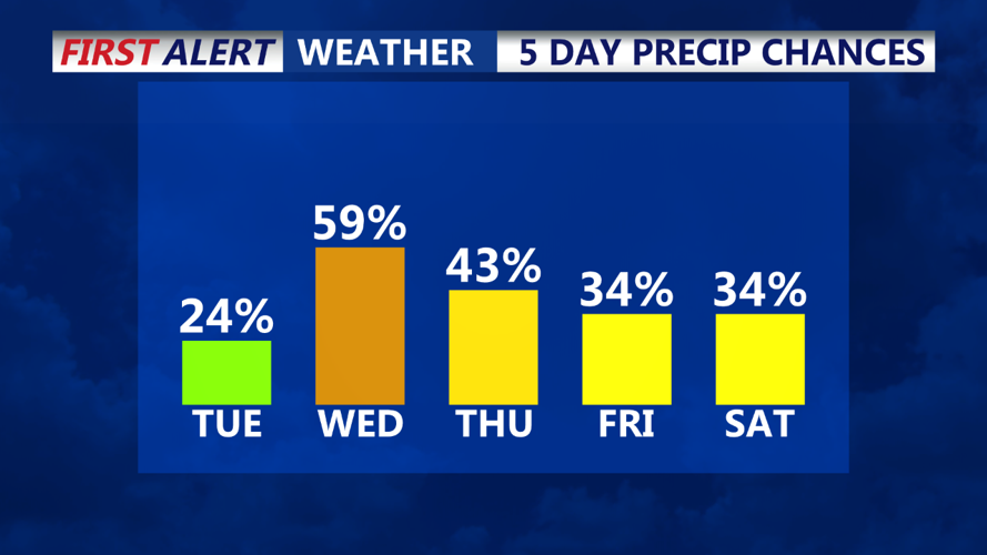
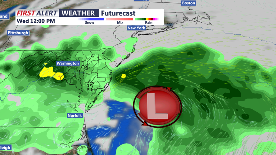
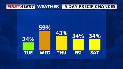
The weather will turn more unsettled late Tuesday night into Wednesday as tropical moisture from the remnants of Potential Tropical Cyclone 8 and a secondary coastal low affect the region. The primary concern will be periods of heavy rain, particularly on Wednesday, as the coastal low parallels the coast. While there is uncertainty about how close the low will track to shore, tropical downpours are possible, especially if the system remains close to the coast.

The flood risk remains low, despite the potential for heavy rain, due to dry conditions over the past few weeks. The Weather Prediction Center currently places southern New Jersey and Delmarva in a Marginal Risk for Excessive Rainfall on Wednesday.
By Wednesday night into Thursday, the forecast becomes more uncertain, with varying model guidance suggesting a continued chance of showers but with low confidence.
Rainfall totals through Thursday are expected to range from 0.50 to 1.00. Daytime highs will remain in the 70s with overnight lows in the 60s, influenced by the warm and humid tropical airmass in place.
A blocking pattern aloft will keep a deep trough near the East Coast through the end of the week, resulting in continued unsettled and cool conditions. Showers remain possible through Friday, but the weekend looks to trend drier as high pressure begins to build in from the north. Temperatures will generally be cooler than normal, with highs in the 70s and lows in the 50s.
Overall, while the end of the week may bring some rain and cooler weather, conditions are expected to improve as we head into the weekend, setting up a potentially more tranquil start to next week.
