



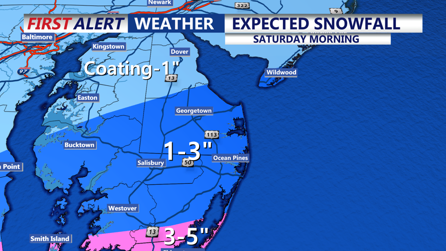

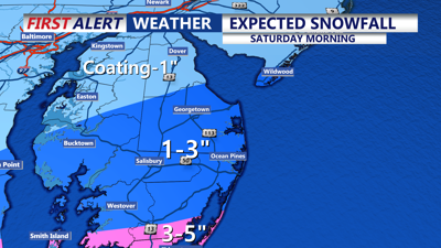
DELMARVA -- Light to moderate snow blanketing the region will wind down through midday, with accumulations ranging from 1-3 inches across Sussex County, Ocean City, Salisbury, and the Eastern Shore. Locally higher amounts of up to 3 inches are possible in southern Delmarva. Areas under a winter storm warning, including Accomack County, may receive totals of 4-5 inches.
As the snow clears, temperatures will hover in the mid-30s this afternoon, but gusty winds from the west-northwest at 25-30 mph will make it feel colder. Skies will remain mostly cloudy before clearing tonight, but motorists should exercise caution as black ice and slick spots are likely to form on back roads, bridges, and highways. Overnight lows will plunge to the upper teens and low 20s.

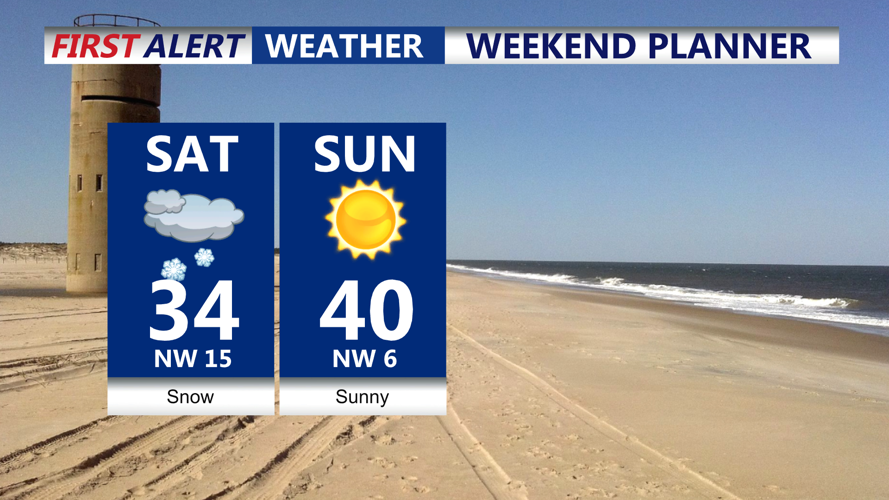
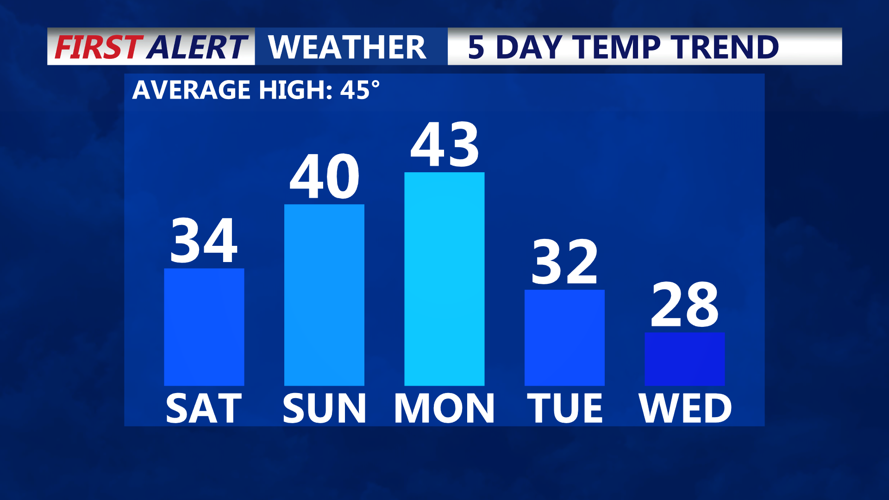
Light snow to start the weekend, sunny finish, near 40.
Sunday offers a reprieve from the wintry weather with mostly sunny skies and highs in the upper 30s to near 40. By Monday, the region will warm slightly, reaching the low 40s under continued sunshine.

Brief mild spell before another reinforcing shot of arctic air
A high-pressure system moving eastward will dominate the region’s weather pattern through Monday, maintaining dry and calm conditions. A weak cold front may approach late Monday into Tuesday, bringing some increased cloud cover but no significant precipitation.
Looking further into the week, temperatures are expected to remain below average through Thursday before moderating to seasonal levels by Friday. High pressure will largely control the weather, keeping the region dry despite occasional gusty winds.
