


DELMARVA- The intense heat continues on this final full day of spring. Temperatures this afternoon with be in the low to mid 90s, with heat indices over 100 in some spots. Be cautious in the heat the rest of today.

Heat indices approach triple digits Thursday afternoon.
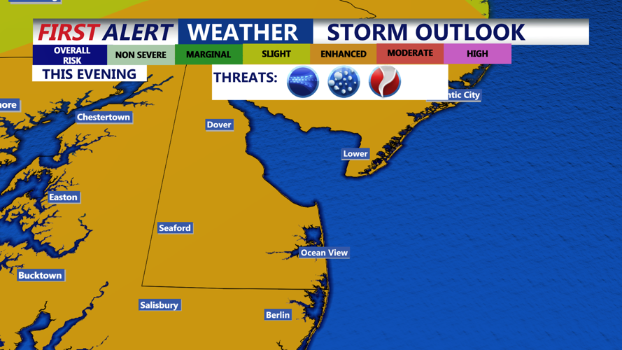
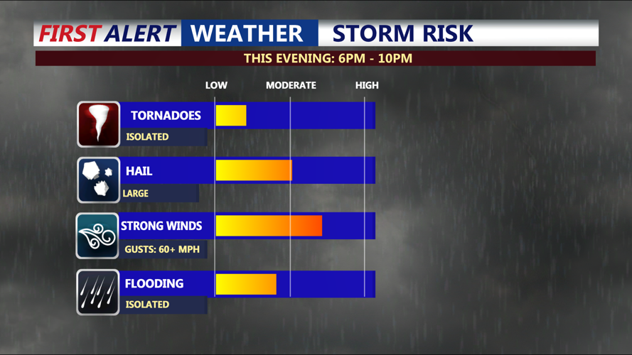
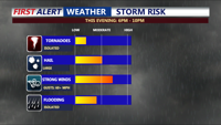
But it won’t just be the heat making headlines. A cold front will approach from the west Thursday evening, triggering strong to severe thunderstorms during the evening and overnight hours. Our entire area is under an Enhanced chance of severe weather this evening. Widespread damaging winds are possible, along with large hail, isolated flooding, and a tornado or two.

Primary threat: Strong straight-line winds, gusts 60MPH+, large hail, torrential downpours/lightning and an isolated tornado.
Storms are most likely between 6 p.m. and 10 p.m., though timing may vary slightly based on the front’s speed. Storms should push offshore or weaken significantly after nightfall. Temperatures fall into the 60s overnight with clearing skies.

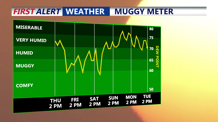
Brief break from the humidity Friday, before rising quickly for over the weekend.
Friday is shaping up to be a beautiful day, with abundant sunshine, lower humidity, and cooler air. Expect highs in the low to mid 80s with dew points near 60, making it feel much more comfortable. A gentle northwest breeze will keep conditions pleasant throughout the day.
Friday night remains quiet and clear, with lows ranging from the upper 50s inland to the mid 60s near the coast.
The weekend begins on a tranquil note. Early Saturday morning temperatures will be in the 60s under mostly clear skies. High pressure remains firmly in control, setting the stage for a dry, mostly sunny Saturday. Temperatures will rebound into the 80s to near 90, with humidity levels staying manageable.
As the weekend goes on, humidity levels will start to creep, especially Sunday. Highs will be in the low 90s, with heat indices in the mid 90s.
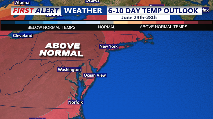
Our first major heatwave of the summer season is possible early to middle part of next week. Expect dry conditions with temperatures well into the 90s with triple digit heat index values.

Big ridge of high pressure build across the eastern U.S. next week, prolong stretch of heat and humidity likely.

