


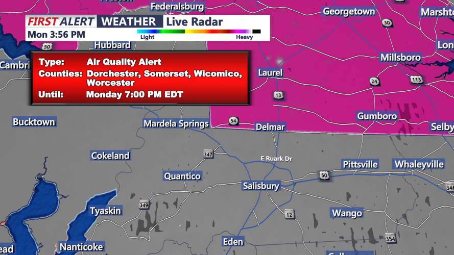
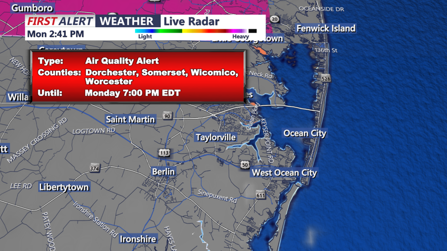

DELMARVA - A thermal trough remains over the east coast, supported by the Bermuda High offshore, maintaining the hot and humid conditions. Showers and thunderstorms will taper off after sunset, leaving behind a warm and muggy night with temperatures settling in the 70s. Patchy fog is expected to develop along the coasts and in areas that experience heavy rain. An air quality warning is in effect until 11 PM EDT tonight, urging residents to limit outdoor activities due to potential health risks.
Tomorrow Morning:
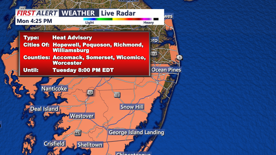
Tuesday morning will see a continuation of the excessively hot and humid conditions. As the Bermuda High continues to influence the weather, temperatures will rise quickly, reaching the upper 90s to near 100 degrees by the afternoon. Dew points in the lower 70s will combine with these high temperatures to produce dangerous heat indices between 105-110 degrees. Excessive Heat Warnings and Heat Advisories are in place for the entire region, underscoring the severe heat risk. Residents are advised to stay hydrated, avoid prolonged sun exposure, and check on vulnerable individuals.
