


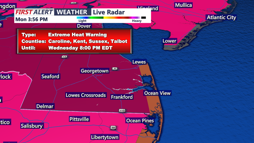


DELMARVA - The relentless heat continues across Sussex County, where the Extreme Heat Warning remains in effect through early Thursday, as temperatures remain dangerously high and relief remains limited.
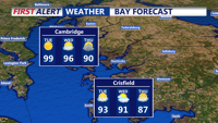
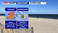
Starting Tuesday morning, the region will continue to feel the effects of an intense upper-level ridge dominating the eastern United States. This weather pattern is driving air temperatures into the upper 90s and low 100s, with heat index values ranging from 105 to 110 degrees across inland areas of Sussex County. Though humidity levels may mix out slightly during the afternoon, the resulting dry heat can be equally hazardous.
The persistent heat is being enhanced by dry west-to-northwest winds, which act to compress and warm the air even more, a phenomenon known as down-sloping. Tuesday may mark one of the hottest days in over a decade for parts of inland Delaware.
Overnight conditions offer little recovery. Temperatures will struggle to fall below the mid to upper 70s, and some urban locations may remain near 80 degrees overnight Tuesday into Wednesday. This lack of cooling at night adds to the stress on the body and increases the potential for heat-related illness.
On Wednesday, highs will once again surge into the mid to upper 90s, with continued high humidity maintaining heat index values above 100. A cold front is forecast to slowly approach the region late Wednesday into early Thursday, offering a chance of isolated thunderstorms and slightly cooler air by daybreak Thursday.
Looking ahead to Thursday morning, the cold front may begin to push farther south, gradually reducing temperatures into the low 90s and potentially ending the heat warning. However, parts of southern Delaware, including Sussex County, may remain hot and humid enough for heat advisories to be extended into the day.
Safety Reminders:
Drink plenty of water and avoid caffeine and alcohol
Stay indoors during peak heat hours (10 a.m. – 6 p.m.)
Use air conditioning, or seek cooling centers if needed
Wear light-colored, loose-fitting clothing
Check on elderly neighbors and pets regularly
Health officials continue to warn of the cumulative effects of prolonged heat, particularly for outdoor workers, children, and the elderly. If you must be outside, take frequent breaks in shaded areas and watch for symptoms of heat exhaustion, such as dizziness, nausea, rapid pulse, or confusion.
This period of heat is part of a larger pattern affecting the Mid-Atlantic region, making early Tuesday through early Thursday one of the most intense stretches of heat this summer.