


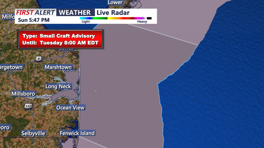


After a warm and sunny weekend on Delmarva, with highs reaching the mid-70s on Sunday, conditions will begin to shift overnight as a cold front approaches from the northwest. Expect temperatures to dip into the upper 50s by late Sunday night, accompanied by an increase in cloud cover and a chance of isolated showers or sprinkles, particularly in northern parts of the region. Rainfall, however, is expected to be light and scattered, with most areas likely remaining dry.
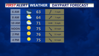
By early Monday morning, clouds will linger over the area, and temperatures will start off cooler than recent mornings, around the mid to upper 50s. Any remaining clouds should clear out by mid-morning, giving way to mostly sunny skies. However, the cooler air mass behind the front will keep temperatures lower than over the weekend, with highs only reaching the mid-60s by Monday afternoon. Expect a brisk northwest breeze around 10 to 15 mph, adding a chill to the air and enhancing the cooler feel across Delmarva.
As the day progresses, dry and stable conditions will settle in, setting up a crisp autumn evening on Monday with temperatures quickly falling after sunset. This cool trend is expected to continue through the early part of the week, giving Delmarva a true taste of fall.
