


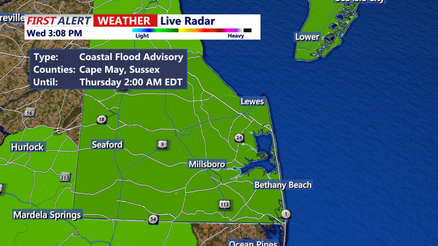


DELMARVA - Tonight, an area of low pressure continues its eastward movement off the coast of New England, allowing a weak cold front to push offshore during the evening. The overnight period will see the emergence of another low pressure system moving east through the Midwestern states. This system will start to push the front back northward as a warm front. Cloud cover will increase again late into the night, with showers possibly starting to enter the region towards dawn, although the trend has been for their arrival to be delayed. Expect overnight lows to range from the 50s to low 60s across southern Delaware.
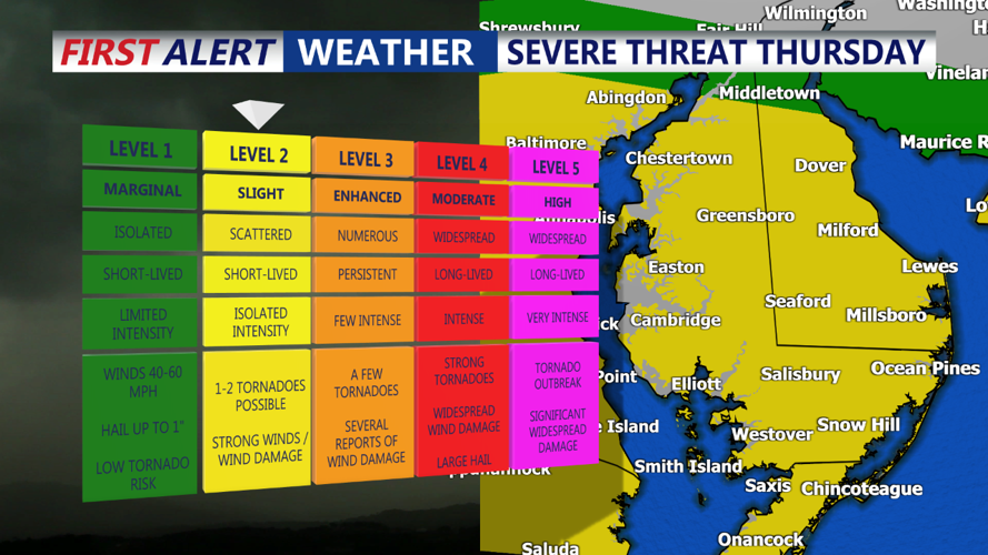
Thursday promises more unsettled weather as the next low pressure area moves through, bringing additional showers and storms, particularly impacting Delmarva and the Sussex County Coastal Towns. The latest models suggest the system will likely track farther south, passing through or near Delmarva. This path could confine the severe weather threat to Delmarva on Thursday afternoon. Currently, the Storm Prediction Center has placed Delmarva under a SLIGHT risk for severe storms. If the system continues to shift south, the severe threat may remain confined to areas south of Delmarva; however, a northward shift could increase the severe weather risk across the broader region. Notably, both speed and directional shear will be strong near the low's track, meaning that, should sufficient instability occur, there is a potential for all threats, including damaging winds, large hail, and possibly tornadoes. Cooler temperatures are expected for Thursday due to the clouds and precipitation, with highs generally staying in the 70s.