



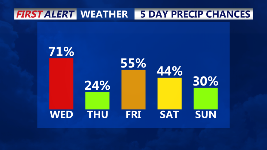
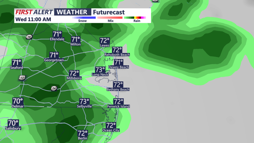

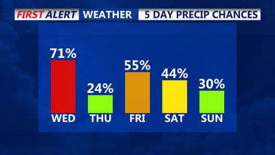
DELMARVA - A low-pressure system and its associated fronts will begin moving through the Delmarva Peninsula today, bringing increasing chances for showers throughout the day. Residents can expect cooler temperatures, with highs only reaching the low 70s. Rainfall will generally be on the light side, with a tenth to twenty tenths of an inch. Winds will be steady from the east-southeast at around 10 mph for much of Wednesday, adding to the cool, damp feel.

Thursday will see a shift in conditions as the warm sector of the system takes over, leading to warmer and more humid weather. Highs are anticipated to climb into the upper 70s to low 80s, with dew points rising to the mid to upper 60s. Skies will be partly to mostly cloudy throughout the day, with the potential for some isolated showers near the coast and urban areas.
Looking ahead to Thursday night, weak surface ridging is expected to move into the area, helping to keep conditions mostly dry, although cloud cover will likely linger. Overnight lows will range from the mid-50s in the northern parts of Delmarva to the mid-60s in the south.
As we approach the weekend, the forecast becomes more uncertain due to a complex weather pattern over eastern North America. An upper-level low over the Canadian Maritimes and another near the Gulf Coast could influence our weather, depending on how they interact with Helene in the southeastern United States. Current trends suggest the possibility of rain this weekend, though confidence remains low. Temperatures through the long-term period are expected to stay near seasonal norms, with highs mainly in the 70s.
