


DELMARVA -- Expect areas of fog to develop across Delmarva tonight, especially in low-lying and coastal areas. Temperatures will remain mild, dipping into the mid to upper 60s. The air will be muggy, contributing to the foggy conditions, so drivers should exercise caution during late-night and early-morning travel.
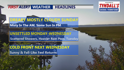
Misty conditions, low clouds and a spotty shower Sunday morning, partly sunny in the afternoon, some breaks in the clouds are possible especially further from the coast. Highs will reach the mid to upper 70s, with a few 80s away from the coast.
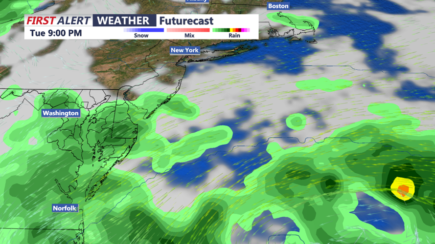
The unsettled weather pattern continues as an upper-level low over the lower Ohio Valley begins to migrate eastward. This low will bring with it a series of shortwaves, leading to scattered showers across Delmarva. The tropical airmass currently over the region will maintain its hold, keeping conditions warm and humid.
As we move into Monday night and Tuesday, there is the potential for more moderate showers, especially with the possible development of a coastal low offshore. While significant rainfall is not expected, isolated downpours could cause localized flooding in poor drainage areas, so stay alert for any weather advisories.

By Tuesday night, a cold front will approach the region from the west, bringing a shift in the weather pattern. This front is expected to cross Delmarva on Wednesday, bringing a brief chance of isolated showers. However, the main story will be the arrival of drier and more stable air behind the front as high pressure builds into the region.
The latter part of the week looks to be much more pleasant, with dry conditions and seasonable temperatures expected to last into the weekend. After the unsettled start to the week, the weather should become more benign, offering a welcome break from the rain.
