


DELMARVA- High pressure continues to slide off the coast overnight into Sunday, ushering in warmer air and breezy conditions. A Yellow Alert is in effect for Monday morning for strong winds and heavy rain.
Overnight expect mostly clear skies and conditions not as chilly, due to a southerly breeze and some cloud cover. Lows in the low to mid 50s.

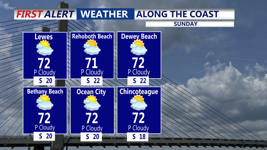
By Sunday, a strong upper-level trough will swing through the Mid-Atlantic, increasing moisture and bringing temperatures into the mid 70s despite growing cloud cover. Dew points will rise as southerly winds strengthen ahead of the approaching front.

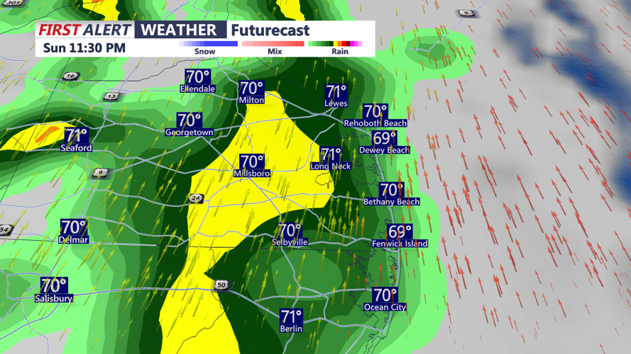
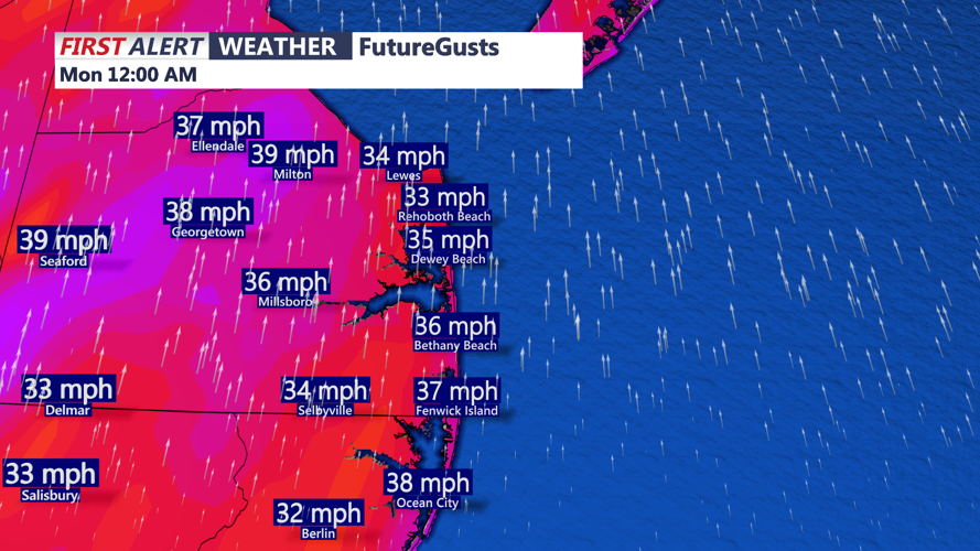
Showers are likely late Sunday night into early Monday. Modest instability coupled with strong upper-level support, could produce a band of heavier showers capable of brief strong wind gusts to near 50 mph. A few rumbles of thunder are possible. Make sure to secure outdoor items Sunday evening. A Yellow Alert has been issued for early Monday for the potential of damaging winds.


The front will clear Delmarva early Monday, but a few lingering showers are possible as cooler air filters in behind it. Otherwise a mix of sun and clouds and highs in the mid 60s.
A brief period of high pressure returns Monday night into Tuesday, allowing temperatures to rebound to near 70 ahead of the next system.
Another cold front is expected Tuesday night, with another round of showers expected. Any showers end early Wednesday, with highs in the 60s.
By Thursday, a larger trough over eastern Canada will usher in cooler air once again, keeping temperatures seasonable and conditions brisk into the latter part of the week.
