


DELMARVA -- High pressure shifts to the south and east of Delmarva on Monday afternoon, setting up a return flow that will help push temperatures several degrees above average for late April. Winds will be variable then turning southwest at 5 to 10 mph inland. Along the coasts, sea breezes will develop by the afternoon. This evening, winds will settle from the south around 5 to 10 mph.
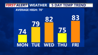
Temperatures this afternoon will rise into the low to mid 70s, signaling the start of a much warmer pattern. Cooler 60s at the coast as the sea breeze kicks in. Monday night will remain mostly clear with lows falling into the mid to upper 40s inland, with 50s at the beaches, as a building upper-level ridge supports continued fair weather.
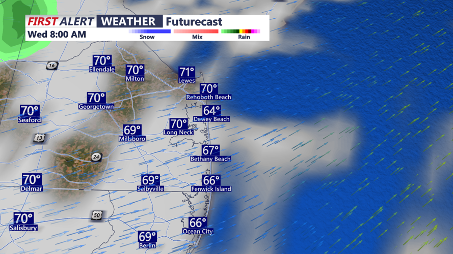
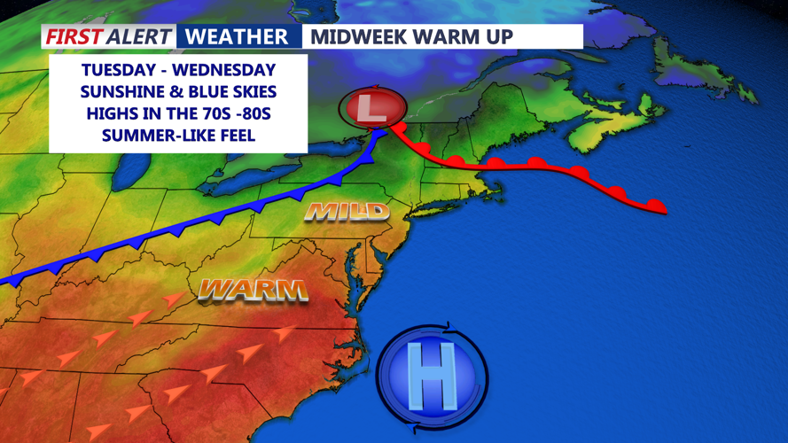
By Tuesday, the return of southerly flow will strengthen, with breezes reaching up to 25 mph. This will help pull even warmer air into the region, pushing daytime highs into the upper 70s and lower 80s. Clouds will begin increasing late Tuesday ahead of a warm front lifting northward. Higher dew points and rising moisture will keep Tuesday night quite mild, with lows holding in the 50s. There is a chance for a few showers Tuesday night and into Wednesday morning as the front approaches.
Wednesday will bring a passing cold front that is expected to stall near or over the Delmarva Peninsula. Despite the front's arrival, it lacks a significant push of colder air. Instead, it will mainly dry the atmosphere out, leading to a west-northwest breeze behind it. Highs will remain warm, ranging from the mid 70s to low 80s across most of the region.
Moving into Wednesday night and Thursday, the stalled front may lift back north as a warm front, but rain chances remain low. Lows in the 50s and 60s are expected. High pressure will slide by to the north, keeping Thursday generally dry and little cooler, with highs in the upper 60s to mid 70s.
By Thursday night and Friday, another system will approach, bringing a better chance for showers and possibly a few thunderstorms. A low-pressure system moving through the Great Lakes and southern Canada will send a cold front toward Delmarva late Friday into early Saturday. Friday will be quite warm ahead of the front, with highs climbing into the upper 70s to mid 80s and humid conditions in place.
After the cold front crosses early Saturday, there could be a few lingering showers, with temperatures closer to normal seasonal levels for the weekend. Highs in the mid 70s Saturday, then dropping into the 60s for highs on Sunday. Drier weather builds in later Saturday into Sunday. Chilly Saturday night into Sunday morning with lows in the 40s and 50s.
