



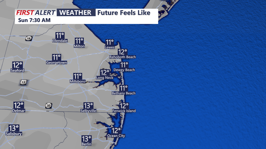

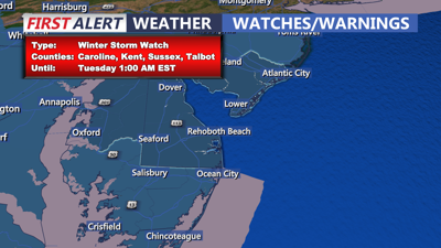
DELMARVA -- An Arctic high-pressure system moving in from Canada is bringing bone-chilling temperatures to Delmarva. Wind chills to dip into the lower teens as gusty west-northwest winds persist. Overnight lows will fall to the lower 20s, with daytime highs on Sunday struggling to reach the low to mid-30s.

Wind Chills In The Teens Sunday Morning
The cold will be accompanied by breezy conditions, with wind chill values in the 20s, making it feel even colder. Will start the day tomorrow under sunny skies and clouds will increase through the day and evening ahead of our snowstorm Monday.

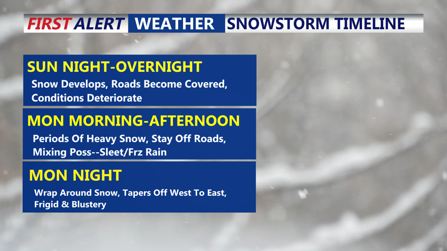
Snow overspreads Delmarva Sunday Night-Monday Morning.
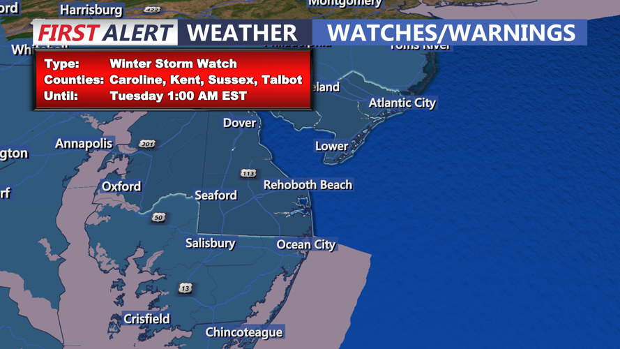
Snowfall is anticipated late Sunday night into Monday morning as a low-pressure system moves across the Mid-Atlantic region. Snow is expected to overspread Delmarva after midnight, intensifying during the Monday morning commute. The heaviest snowfall is likely during the morning-midday hours, creating travel hazards.
While most of the peninsula will see snow, some parts of Delaware, Maryland and Virginia may experience a brief changeover to sleet, though freezing rain is not currently a significant concern. Caution that slight changes in the storm's track could result in considerable differences in snowfall totals.
By Monday evening, snow may taper off in northern areas, though a second round of snowfall is possible overnight in southern parts of Delmarva. As the system moves offshore Tuesday, gusty northwest winds will develop, leading to single-digit wind chills and ensuring the snow lingers on the ground.

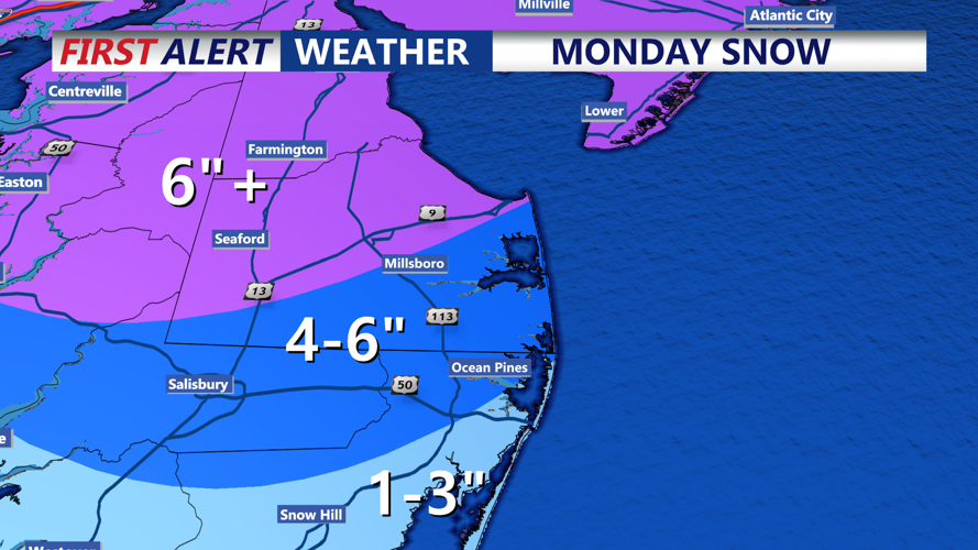
Latest Snowfall Map For Monday Snowstorm
Cold high pressure will dominate through the remainder of the week, with highs in the low 30s and lows in the upper teens to lower 20s. Winds will keep the region feeling colder, and conditions are unlikely to warm above freezing until Friday.
We are are also keeping an eye on next weekend, as early models hint at the possibility of another low-pressure system bringing additional snow Friday night or Saturday.
