


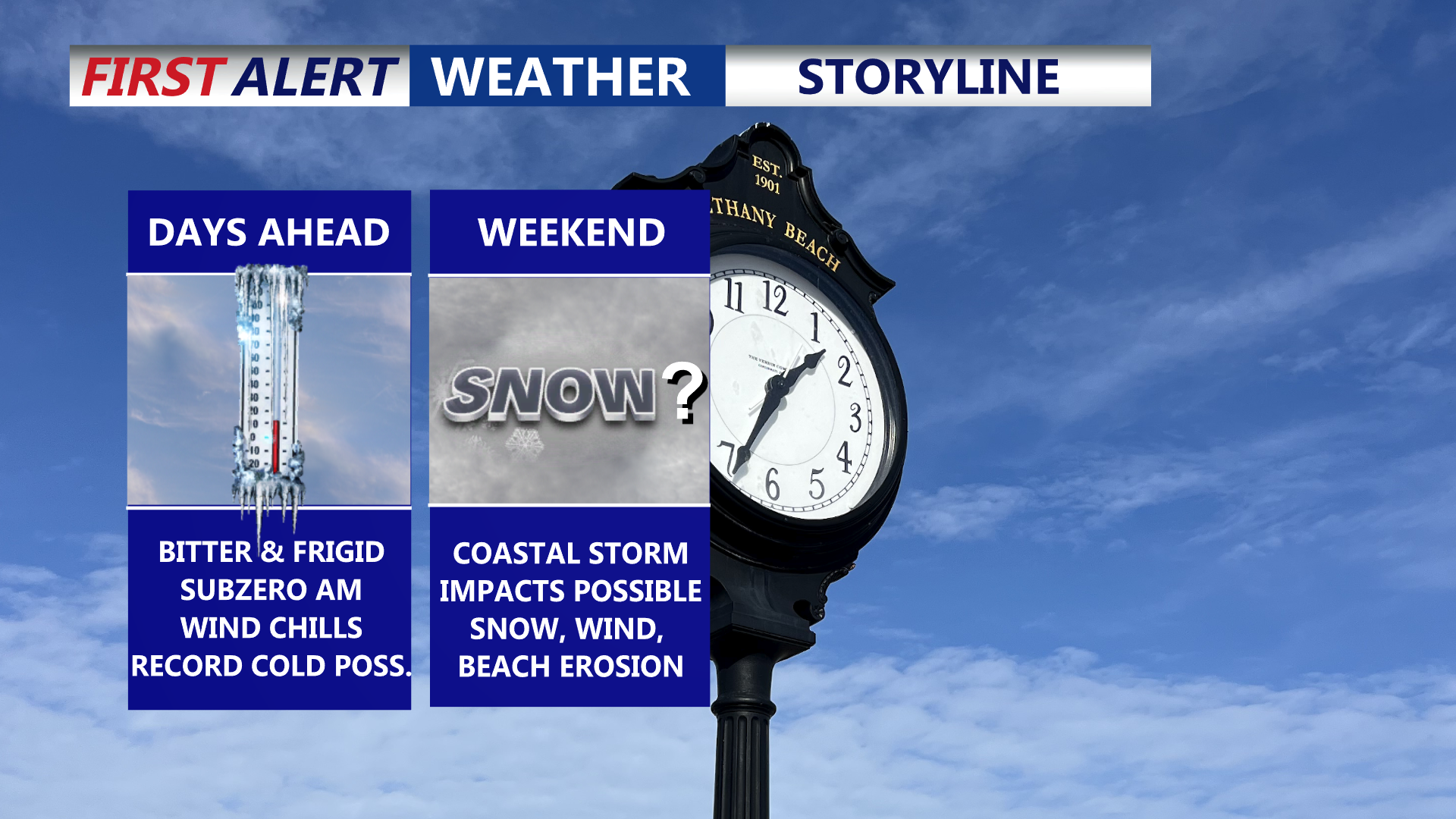

Delmarva is settling into a prolonged, dangerous stretch of cold through the end of the week, with daytime highs stuck in the 20s and overnight lows dropping into the single digits—creating wind chills below zero at times. Friday could challenge a record for the coldest high temperature. Attention then turns to a rapidly strengthening coastal storm this weekend that could bring snow, high winds, and coastal flooding, though the exact track (and impacts) remain uncertain.
From
To

Mostly sunny skies today will give way to a burst of dangerous arctic cold Friday night, then a high-impact winter storm threat Saturday night through early Monday, followed by days of bitter cold.

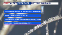
Sussex County is set for a sharp drop to around 9 degrees Tuesday night, then a sunnier, less harsh Wednesday with highs reaching the 30s and low 40s — warmest near the coast.

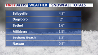
Some of Delmarva woke up Thursday to a blanket of powdery snow, while others saw nothing at all. A sharp precipitation cutoff left areas north of Georgetown mostly dry, while southern Sussex County recorded 1 to 4 inches, and Chincoteague measured 6.5 inches. Bitter cold and gusty winds dominate the forecast, with wind chills dropping into the single digits overnight. A Winter Weather Advisory remains in effect for parts of the Lower Shore until 6 p.m. Friday will bring sunshine but remain brisk before a milder, calmer weekend.


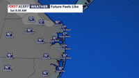
A departing coastal storm and an approaching high-pressure system will bring continued cold temperatures, gusty winds, and scattered snow showers to Sussex County and Ocean City through Saturday before a slight warming trend begins late in the weekend.

Temperatures across Delmarva will remain frigid late Wednesday into Thursday, with single-digit lows overnight and highs only reaching the 20s to mid-30s under partly sunny skies.


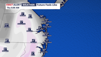
Dangerous cold and a chance of coastal snow will affect Sussex County and Ocean City into Thursday morning, with freezing conditions and icy hazards continuing.

Arctic air has settled over Delmarva, bringing dangerously cold temperatures through Wednesday morning. Highs today will struggle to reach the low 20s, with wind chills making it feel even colder. A Cold Weather Advisory remains in effect, and light snow is possible along the coast tonight into Wednesday morning. Temperatures will begin to improve on Thursday, with a gradual warming trend extending into the weekend.

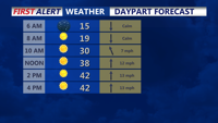
Delmarva is currently experiencing heavy snowfall, with rates of 1 to 2 inches per hour. The snow will continue through the morning, before a brief lull this afternoon, followed by another round of snow this evening. Early snowfall reports show 3-6 inches already on the ground in many areas. Travel today is not recommended as roads are covered in snow, and conditions will continue to worsen.

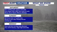
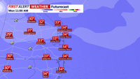
Bitter cold conditions will grip Sussex County through Saturday night and Sunday, with lows in the teens and highs struggling to reach the mid-30s. Forecasters are monitoring a potential snowstorm expected to impact the area late Sunday night into Monday.