


DELMARVA - A bitterly cold air mass settles over Sussex County late Tuesday evening as winds ease and skies stay mostly clear. With the breeze expected to diminish overnight, conditions favor strong radiational cooling, sending temperatures down quickly after sunset.
Expect the coldest inland spots — including areas around Georgetown, Millsboro and western Sussex — to bottom out around 9 degrees Fahrenheit by early Wednesday. Beach towns such as Lewes, Rehoboth Beach, Dewey Beach, Bethany Beach and Fenwick Island should run a bit milder, generally in the low to mid-teens, though it will still be dangerously cold.
Because winds are expected to relax overnight, wind chill should not be as big a factor as earlier in the day. Still, any lingering breeze near the coast could make it feel a few degrees colder at times. Drivers should watch for refreeze on untreated surfaces, especially bridges, overpasses and shaded roadways.
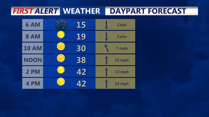
Wednesday starts frigid but improves during the afternoon as southerly flow develops and temperatures rebound. Highs are expected in the 30s inland, with upper 30s to low 40s closer to the beaches. By late Wednesday evening, temperatures will begin sliding again after sunset, setting up another cold night.
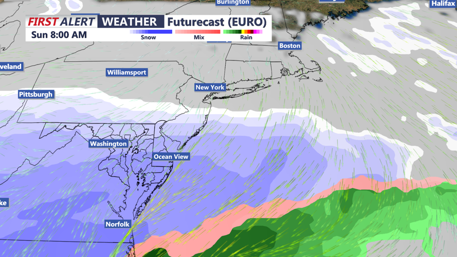
Looking ahead to the weekend, there is increasing potential for a winter storm late Saturday through Sunday night, though the track — and how much snow falls where — remains uncertain.
