


A cold front is moving through Delmarva this afternoon, bringing an end to the rain. While daytime highs will remain warm, dew points are forecast to drop modestly behind the front, offering some relief from the oppressive humidity of recent days.
From
To

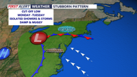
The week begins unsettled across Delmarva, as an upper-level low parked over the Ohio Valley on Monday continues to drive clouds and showers across the region. High temperatures will reach the low to mid 70s inland, while coastal areas remain cooler in the 60s.


We'll see occasional rain through the end of the week with colder temperatures, then icy cold into the weekend and early next week.

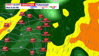
A code red continues the rest of the day for Delmarva. Watch for heavy rain, potentially damaging winds, and isolated severe storms.

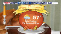
It was a soggy Thanksgiving for Delmarva, however conditions are beginning to dry out the remainder of the day. Cool through the end of the week, then sharply colder for the weekend.

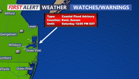
We're seeing a clearing trend and cool weather to end the week, with a dry and mild weekend. Some tidal flooding is possible into Saturday.

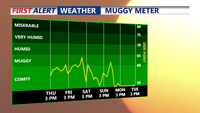
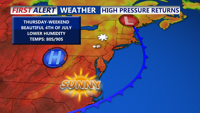
A drying trend is in progress, as a series of cold fronts moving through Delmarva the next few days, will bring more sunshine and lower humidity.

A cold front moving across the region tonight will bring cooler temperatures by Thursday, ending today’s heat spike. The front will stall and reverse as a warm front by Friday night, bringing changing conditions through the weekend.

A cold front crossing Delmarva will bring cooler temperatures, reduced humidity, and a stretch of pleasant weather from Thursday night through Friday night.