


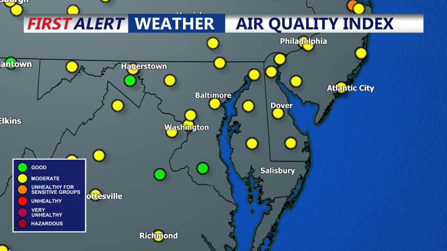


DELMARVA - The cold front should fully cross through the region by Thursday morning but will begin to slow down as it passes to our south and east. While the northern half of the area will begin to see some clearing, the southern half of the area (especially near the coast) will see cloud cover linger throughout the day. Isolated showers and storms may hang up along the coast as well, but overall, this chance remains uncertain and low. On the bright side, this cold front will knock down temperatures and humidity with highs mainly in the low to mid 80s.
A great stretch of more pleasant weather is expected during the short term. Thursday night will be the first in a while without significant amounts of humidity, and temperatures will be cool as well. Lows are expected to drop into the upper 50s to low 60s for the far northwest areas while the remaining locations will have lows in the mid to upper 60s. There could be some patchy fog around too, especially in areas that get some heavier rains in the near term.
Weak high pressure ridges across the Middle Atlantic region on Friday. A dry day is expected with seasonable temperatures and comfortable humidity levels. High temperatures will mostly be in the low to mid 80s for the region. The dew points will be in the upper 50s to low 60s for the area, bringing much lower humidity levels, which are welcome. Winds will be west to northwest at 5 to 10 mph. Fair weather continues Friday night with temperatures seasonably mild, just like the previous night.
