




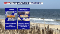
Delmarva turns warmer and more humid before a cold front brings showers and thunderstorms Thursday night.
From
To

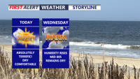
Delmarva stays sunny and comfortable today before warmer, more humid weather and a chance for storms arrive late Thursday.


Delmarva faces a potentially active weather day as a strong cold front brings widespread showers and thunderstorms to the peninsula. Damaging wind gusts, flash flooding and a few tornadoes are possible late this afternoon and evening, with some areas potentially receiving several inches of rain. Unsettled weather will continue through the weekend before drier conditions return early next week.
Mostly sunny and seasonable weather Wednesday will give way to increasing clouds and a growing chance of showers by early Thursday.


Saturday is expected to be the driest and most comfortable day of the weekend, before humidity and storm chances return Sunday.


Delmarva will enjoy a warm and mostly pleasant Thursday with hazy sunshine and highs in the upper 80s to low 90s. A cold front will slowly move south through Friday, eventually ushering in cooler and less humid weather for Saturday. Saturday looks like the pick of the weekend before humidity and storm chances return Sunday afternoon into Monday. A low rip current risk is expected today, while spotty minor tidal flooding will be possible along portions of the Delmarva coast during Thursday evening’s high tide.

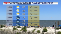
Delmarva will see a mix of sun and clouds Wednesday with temperatures reaching the mid to upper 80s. An isolated sea-breeze shower or thunderstorm cannot be ruled out this afternoon, with additional rounds of showers and storms possible Wednesday night through Friday. A cold front should clear the region late Friday, bringing cooler temperatures, lower humidity and mainly dry weather for the weekend. Minor tidal flooding is also possible along portions of coastal Delaware around the evening high tides.


Delmarva will remain hot and humid through the middle of the week with daily chances for showers and thunderstorms. Some storms could produce strong winds, heavy downpours and localized flash flooding, while minor tidal flooding is also possible along Delaware’s Atlantic coast and Delaware Bay during evening high tides. A cold front should bring cooler, much drier and more comfortable weather by Friday and Saturday.

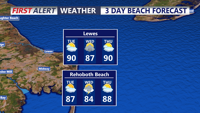
Showers and thunderstorms will remain possible Tuesday into early Wednesday, with locally heavy rain, gusty winds and minor tidal flooding concerns.

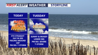
Hot and humid weather continues across Delmarva today, with highs reaching the upper 80s to mid 90s and heat index values approaching 100 degrees in some locations. Showers and thunderstorms are expected to develop later today, with southern Delaware and portions of Maryland’s Mid-Shore under a Marginal Risk for severe weather