



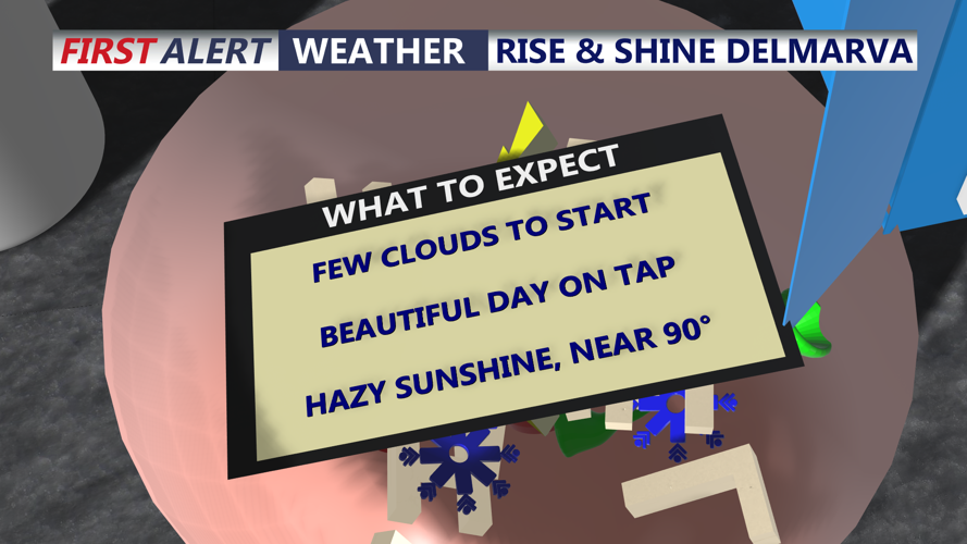


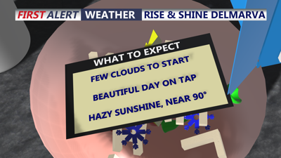
DELMARVA -- A beautiful summer day is shaping up across Delmarva today, with just a few clouds around to begin the morning. Few spotty showers are moving through before dawn. Temperatures out the door are generally in the 60s to low 70s under partly to mostly cloudy skies.
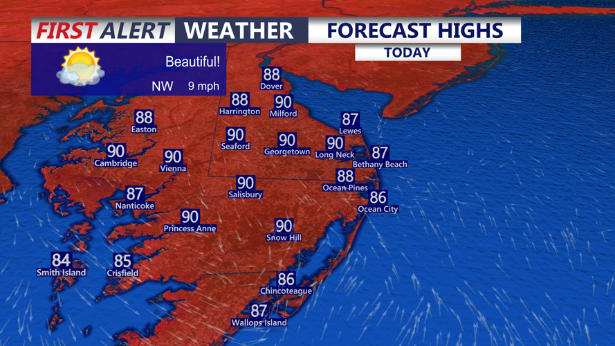
Hazy sunshine will develop as the day progresses, allowing temperatures to climb into the upper 80s to low 90s across the peninsula. Despite the summer heat, much of the day should remain dry. Beachgoers will also find a low risk for rip currents along the Delmarva coastline.

Highs today in the upper 80s to low 90s, not overly humid.
Tonight will remain pleasant with partly cloudy skies and overnight lows settling into the upper 60s to low 70s.

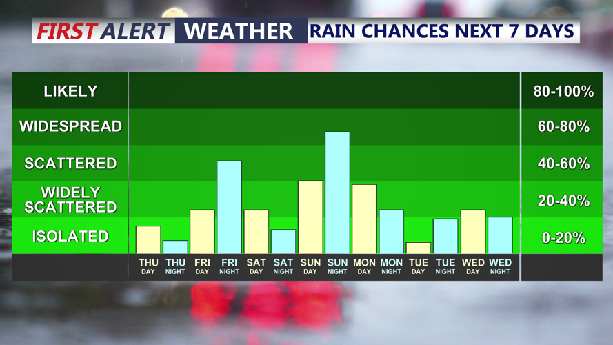
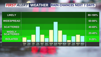
Few showers Friday afternoon into the evening, then another chance of rain Sunday night.
A cold front will gradually sink south across Delmarva through Thursday and Friday, beginning a transition toward somewhat cooler and eventually less humid conditions. Most locations should remain dry Thursday, with the more noticeable change in temperature and humidity arriving Friday and especially Saturday.

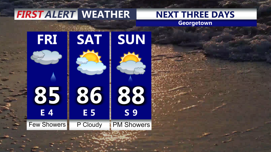
Partly sunny skies Friday, few showers and a rumble of thunder afternoon-evening, shaping up to be a very nice weekend.
Friday will feature partly sunny skies with highs mainly in the mid 80s. A few showers could develop Friday afternoon or Friday night as the front continues pushing farther south.
By Saturday, high pressure is expected to settle over the region, delivering what should be the driest, coolest and least humid day of the weekend. High temperatures will range from the upper 70s to mid 80s, while lower humidity should make conditions feel noticeably more comfortable.
High pressure will remain in control through at least the first half of Sunday. The morning is expected to remain largely dry, but the high will begin shifting offshore as the day continues. Southerly flow will then bring warmer temperatures and increasing humidity back to Delmarva, with highs returning to the mid and upper 80s.
Rain chances will also begin increasing Sunday afternoon as the next weather system approaches.
More unsettled weather is expected Sunday afternoon through Monday as low pressure tracks toward the Mid-Atlantic. Showers and thunderstorms will become possible across Delmarva, and the atmosphere is expected to contain plenty of moisture. Any stronger thunderstorms that develop could produce heavy downpours.
There may also be enough instability for a few stronger storms, although it remains too early to determine the exact severe weather or flash flooding threat for Delmarva. The potential will become clearer as the system gets closer.
Along the coast, spotty minor tidal flooding will also be possible during Thursday evening’s high tide, particularly around portions of Delaware’s Atlantic coastline and Delaware Bay. Astronomical tides remain elevated following Wednesday’s New Moon, although water levels are expected to gradually trend lower as the region moves farther away from the lunar cycle.
Overall, Delmarva will enjoy a warm and hazy Thursday before conditions gradually improve heading into the weekend. Saturday remains the standout day for outdoor plans, with cooler temperatures and lower humidity, before warmer, more humid and increasingly unsettled weather returns Sunday afternoon into Monday.
