



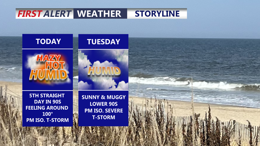

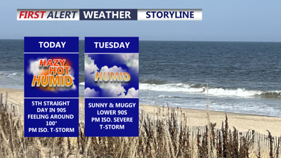
DELMARVA -- Hot and humid conditions will remain in place across the peninsula today and into the middle of the week, although the humidity should become somewhat less oppressive than it has been in recent days.
Bermuda high pressure positioned offshore will help maintain a very warm and moist air mass across Delmarva through the first half of the week.

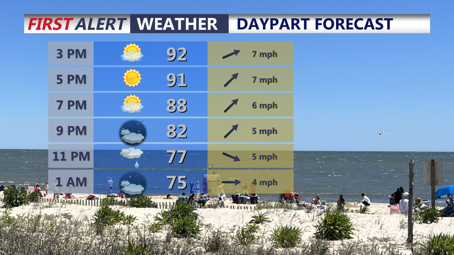
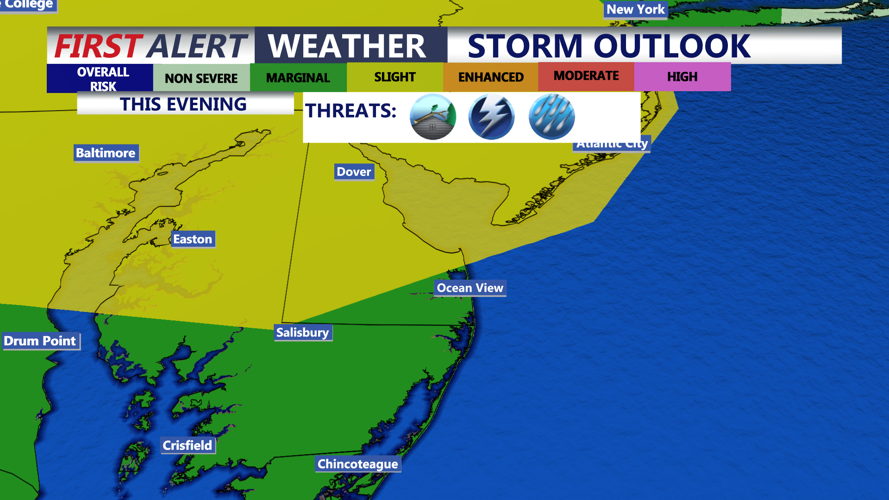
An isolated gusty t-storm/shower is possible this evening.
Temperatures today are expected to climb into the upper 80s to mid 90s. Dewpoints should mix down into the mid to upper 60s this afternoon, offering at least some relief from the recent excessive humidity. Even so, maximum heat index values will generally reach the mid to upper 90s, with a few locations potentially approaching 98 to 103 degrees.
Attention will then turn to the potential for thunderstorms later today.
A disturbance moving toward the region is expected to arrive near the time of peak afternoon heating and instability, creating an environment favorable for showers and thunderstorms from the mid-afternoon into the early evening.
The Storm Prediction Center has placed southern Delaware and portions of Maryland’s Mid-Shore in a Slight risk Leve 2 out of 5 and a Marginal Risk, Level 1 out of 5, for the Lower Shower, for the threat of severe thunderstorms later today.

An isolated severe storm is possible, especially along the mid-shore this evening, damaging winds in the primary threat.
There remains some uncertainty over exactly how storms developing farther west will evolve before reaching Delmarva. They could maintain their organization as they approach the peninsula or weaken before strengthening again later in the day.
The primary severe-weather concern will be damaging wind gusts.
Locally heavy rainfall will also be possible. Atmospheric moisture levels will increase again, with precipitable water values potentially approaching two inches. However, because storms are expected to move relatively quickly, the overall flash-flooding threat should remain limited.
Delmarva remains within a Marginal Risk, Level 1 out of 4, for excessive rainfall, meaning isolated instances of flooding could occur where the heaviest rain develops.
The most favorable period for thunderstorms today currently appears to be from the mid-afternoon through early evening. Tonight will fall into the mid 70s under mostly clear skies and some patchy fog.

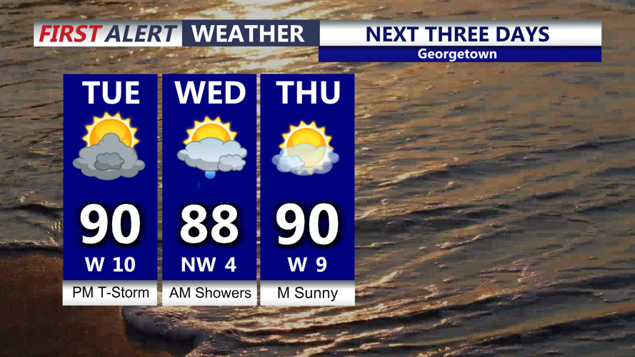
Highs hovering around 90, chance of gusty t-storms late Tuesday afternoon-evening.
The severe-weather threat appears somewhat lower Tuesday, but showers and thunderstorms will remain possible across Delmarva.
The severe-weather threat appears somewhat lower Tuesday, but showers and thunderstorms will remain possible across Delmarva.
A faster-moving cold front and upper-level disturbance should shift the greatest atmospheric instability farther southwest. Delmarva could still experience scattered convection or remnants of thunderstorms developing farther upstream later in the day or evening.
Exactly what happens Tuesday may also depend on the evolution of today's storms.
High temperatures Tuesday through Thursday are expected to generally range from the mid 80s to near 90 degrees, with heat index values mainly in the mid 80s to mid 90s. Those conditions are much closer to normal for early to mid-August.
A cold front is expected to stall northwest of Delmarva Tuesday into Wednesday. Several disturbances moving along the stalled boundary will keep opportunities for afternoon and evening showers and thunderstorms in the forecast through at least Wednesday and possibly into Thursday.
Temperatures and dewpoints should decrease somewhat by Wednesday, providing another modest improvement in comfort despite continued chances for storms.
The stalled front is expected to finally push through Delmarva by late Thursday.
Behind it, a noticeably cooler and much drier air mass will spread across the peninsula Friday and Saturday, sharply reducing the chance for thunderstorms and bringing some of the most comfortable weather Delmarva has experienced in several days.
Afternoon highs Friday and Saturday are forecast to settle into the low to mid 80s, while dewpoints could fall into the 50s across many communities.
That combination will produce significantly lower humidity and much more pleasant conditions heading into the weekend.
Humidity will begin to slowly increase again Sunday as dewpoints return to the 60s, but the most oppressive heat and humidity of recent days will have departed.
