



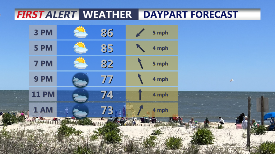
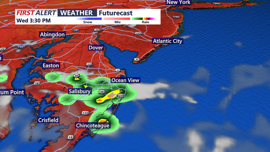

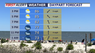
DELMARVA -- A mix of sunshine and clouds across the peninsula, with highs climbing into the mid to upper 80s. Most of the region should remain dry during the daytime, although an isolated shower or thunderstorm could develop along the sea breeze during the afternoon.

Isolated shower/thunderstorm possible with the sea breeze this afternoon.
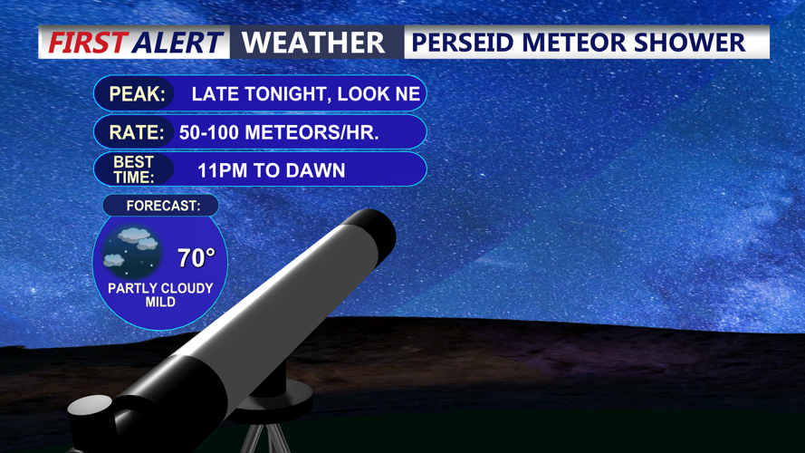
The weather becomes more unsettled Wednesday evening and overnight as another round of isolated showers and thunderstorms approaches Delmarva. Exactly how widespread those storms become remains uncertain and will depend in part on the evolution of thunderstorm clusters moving out of the Ohio Valley. Otherwise will remain partly cloudy and lows around 70. Perseid Meteor Shower will peak tonight, best chance to view up to 50 to 100 meteors per hour will be after 11pm through dawn.

Look to the skies tonight after 11PM for up to 50 to 100 meteors per/hour.
A nearly stationary frontal boundary will remain close to Delmarva through Thursday before gradually sinking southward into Friday. Several disturbances moving along that boundary could trigger additional rounds of showers and thunderstorms. Expect mostly sunny hazy skies Thursday, with highs around 90.
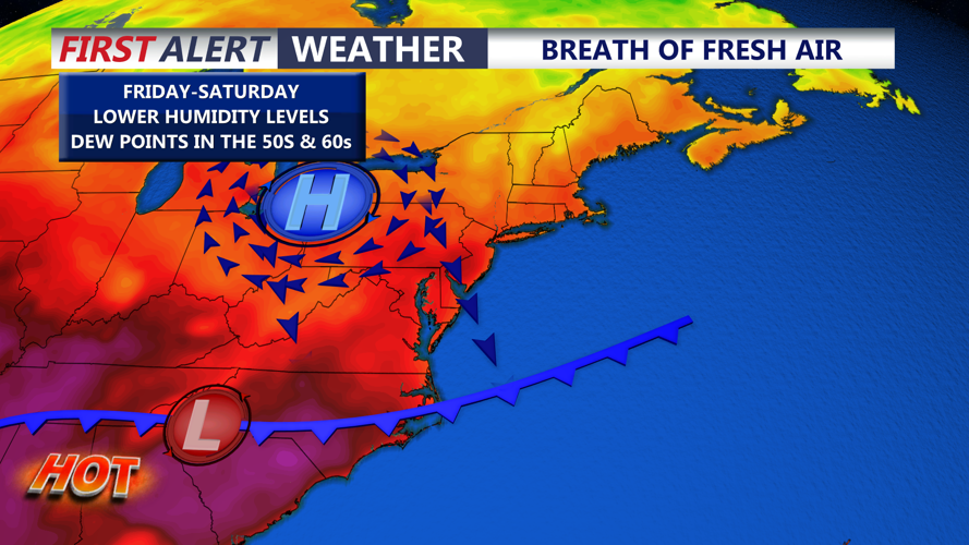
As the front drifts farther south Thursday and Friday, cooler and drier air will begin filtering into areas north of the boundary. Isolated showers and thunderstorms may continue closer to and south of the front until it finally moves through the region late Friday. Highs Friday will be in the mid 80s.
That frontal passage should set the stage for a much more comfortable weekend across Delmarva.

Cold front will move in late Thursday and into Friday bringing some lower humidity to the region.
High temperatures Saturday and Sunday are expected to settle into the low to mid 80s. Saturday should feature especially pleasant humidity levels, with dew points falling into the mid 50s to lower 60s. Humidity will begin increasing again Sunday, with dew points returning to the mid and upper 60s.
Most of the weekend is expected to remain dry, although another round of showers and thunderstorms could approach Delmarva late Sunday and continue into Monday.
Astronomical tides are running higher around Wednesday's New Moon, while water levels have also been running above normal. The combination could result in spotty minor tidal flooding around the evening high tide, particularly along Delaware's Atlantic coast and Delaware Bay.
Coastal Flood Advisories remain in effect for Wednesday evening's high tide cycle, with the highest astronomical tides occurring Wednesday. The risk for minor tidal flooding could continue into Thursday or Friday depending on water-level departures.
Tidal flooding is not currently forecast along the Eastern Shore of the Chesapeake Bay.
For Delmarva, the overall weather pattern will remain somewhat unsettled through the end of the workweek before a late-Friday cold front opens the door to cooler, less humid and more comfortable conditions for the weekend.
