




DELMARVA -- A strong cold front will move through the region today, bringing showers and thunderstorms and the potential for severe weather and flash flooding across Delmarva.
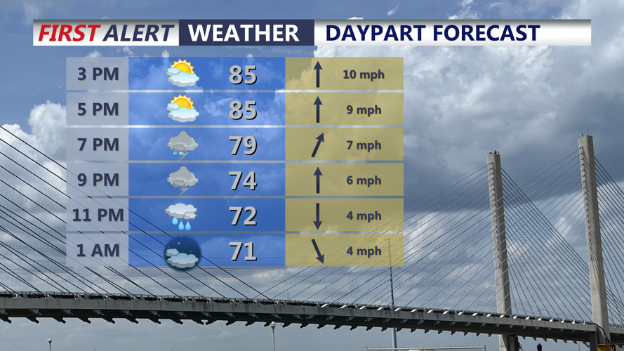
Highs today will be 84 to 91 inland and 82 to 87 at the beaches ahead of storms late today.

Expecting strong to severe storm to push through the peninsula through the evening.
Storms are expected to become more widespread during the late afternoon and continue into the evening. Some could initially develop as more isolated thunderstorms before organizing into clusters or lines as they move across the peninsula.
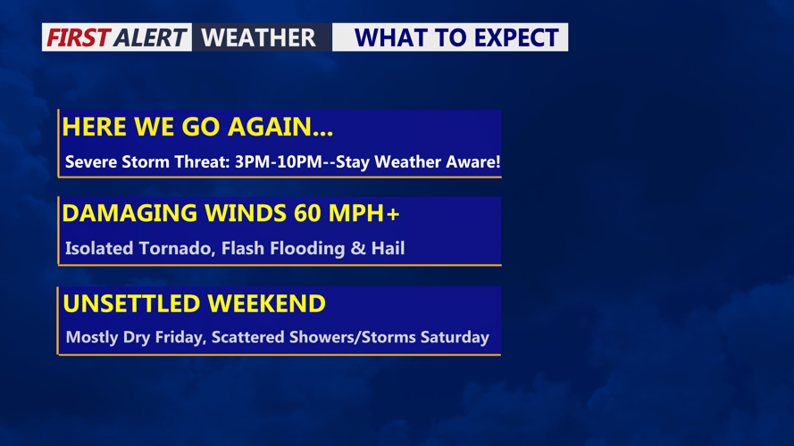
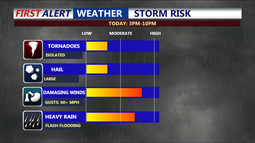
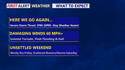
Damaging wind gusts will be one of the primary severe weather threats. Atmospheric conditions will also support the possibility of isolated tornadoes, particularly where storms interact with a warm front positioned across portions of Delmarva. An isolated tornado cannot be ruled out across southern Delaware and the Lower Eastern Shore. Isolated large hail is also possible.

Damaging wind gusts 60 mph+ is the main threat, an isolated tornado can't be ruled out as well as flash flooding.
Flash flooding could become an equally significant concern. A very moisture-rich air mass will allow thunderstorms to produce extremely heavy rainfall, with rates potentially reaching 2 to 4 inches per hour in the strongest storms.
Most locations could receive between 1 and 2 inches of rain, although localized totals of 3 to 5 inches are possible where multiple storms move over the same areas. The combination of intense rainfall and repeated rounds of storms could quickly lead to flooded roads and poor drainage areas.
The timing of the heaviest storms could overlap with the evening commute, creating potentially hazardous travel conditions. Residents should have multiple ways to receive weather warnings and should never attempt to drive through flooded roadways.

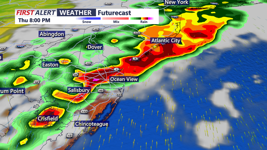
Strong clusters of storms push through the area at to the coast between 6PM-10PM
The severe weather and flooding threat should gradually diminish overnight into Friday morning, but the unsettled pattern will remain. Mostly cloudy skies overnight as we dip into the upper 60s to low 70s.
Friday looks to be pretty decent and dry, after some morning clouds partly sunny skies, cooler highs in the upper 70s to low 80s.
A front is expected to stall just offshore, allowing several waves of low pressure to move along it through the weekend. Additional periods of showers and thunderstorms are possible each day, with Saturday and Sunday both carrying renewed chances for rain.
The severe weather threat over the weekend currently appears lower, but additional heavy rainfall could create flooding concerns, especially in communities that receive the most rain today.
Temperatures through the weekend should remain seasonable for late August, although elevated humidity could make conditions feel uncomfortable at times.
A change arrives early next week as high pressure builds into the region, bringing Delmarva a return to fair and more tranquil weather. Seasonable temperatures are expected before the weather pattern potentially becomes more active again toward the middle or end of next week.
