





DELMARVA -- Hot and humid weather will continue across Delmarva today as the region enters an unsettled stretch featuring several opportunities for showers and thunderstorms through the middle of the week.

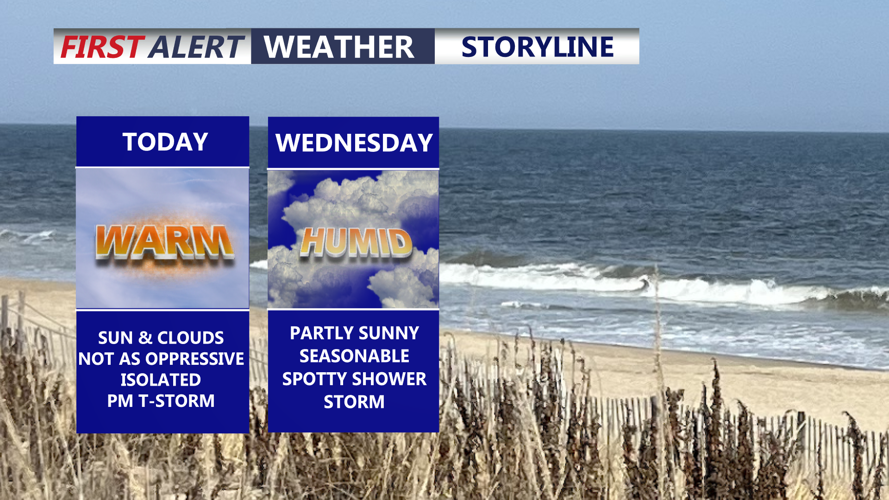
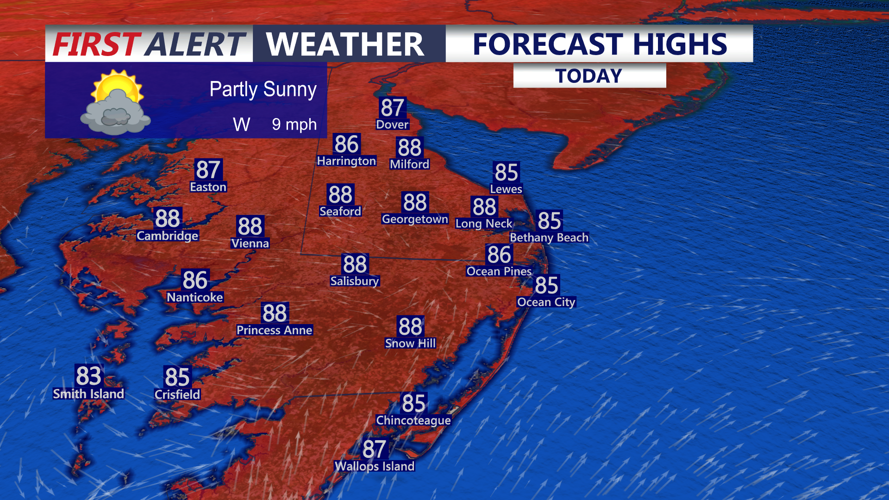
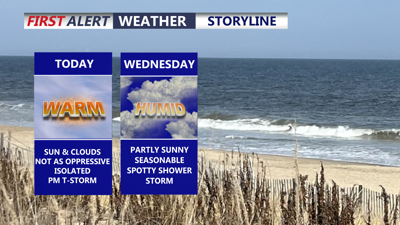
Partly sunny skies, warm and humid highs in the 84 to 91, can't rule out an isolated gusty t-storm late afternoon-evening.
Today will remain warm and muggy, with afternoon temperatures generally reaching the upper 80s to mid 90s. Humidity levels will be somewhat lower than during the most oppressive days recently, with heat index values primarily reaching the mid to upper 90s.

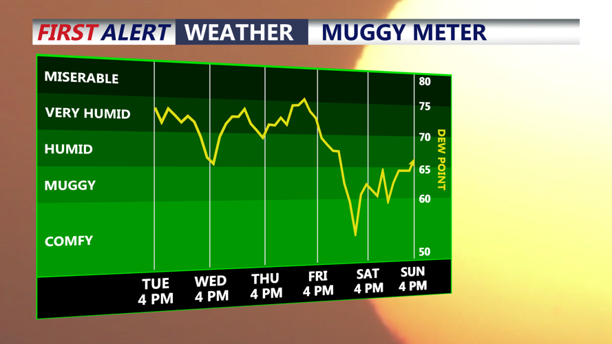
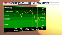
Humidity levels drop into the end of the week, dew points falling into the 50s.
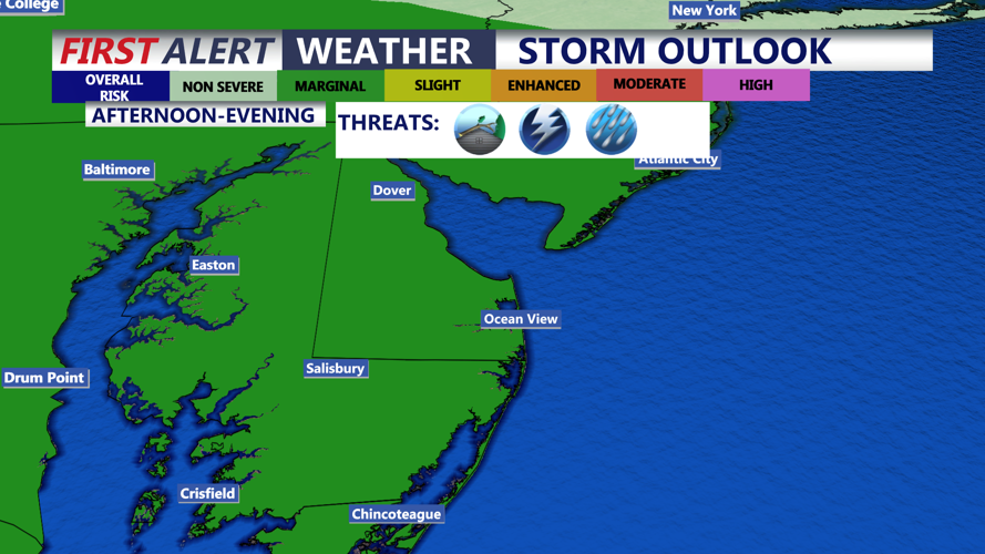
Isolated to scattered showers and thunderstorms will be possible this afternoon and evening. While the overall severe weather threat appears limited, any stronger storm could produce gusty winds, frequent lightning and locally heavy rainfall.

Marginal severe risk this afternoon-evening, damaging winds and flash flooding are the primary threats.
Forecast confidence decreases somewhat later today and tonight because thunderstorm complexes developing well west of Delmarva could influence the region. Depending on how those storms evolve, remnants could reach portions of the peninsula during the evening or overnight.
A few showers and perhaps a rumble of thunder will remain possible tonight, with temperatures falling into the low 70s.
Another round of showers and thunderstorms could arrive early Wednesday morning. Some storms may contain heavy downpours around the morning commute, although there remains considerable uncertainty over exactly where and when the heaviest rain will develop.
Additional rounds of showers and thunderstorms are possible Wednesday afternoon, Wednesday night and potentially into Thursday as a frontal boundary stalls just north of Delmarva. Repeated storms over the same locations could produce localized areas of excessive rainfall and flash flooding.
Hot and humid conditions will continue Wednesday, although temperatures and humidity should begin easing slightly. The front is expected to gradually move through the region by late Thursday. Highs will be in the upper 80s to near 90 both Wednesday and Thursday.
Coastal communities will also need to keep an eye on evening high tides this week. Astronomical tides are increasing ahead of Wednesday’s New Moon, and water levels are already running somewhat above normal.
Minor tidal flooding is possible around the evening high tides along the Delaware Bay and Delaware’s Atlantic coast, especially today and Wednesday. Coastal Flood Advisories are in effect for areas along the Delaware Bay for this evening’s high tide, and additional advisories may be needed later this week.
At least spotty minor tidal flooding could linger through Thursday or Friday. Tidal flooding is not currently expected along the Eastern Shore of the Chesapeake Bay.
A noticeable change arrives late in the week. Once the front clears Delmarva, a much cooler and drier air mass will settle across the peninsula for Friday and Saturday.
High temperatures are expected to fall into the low to mid 80s, while dew points could drop into the 50s in many locations. That will provide a significant break from the recent heat, humidity and daily thunderstorm chances.
Humidity is expected to begin increasing again by Sunday, but Friday and Saturday currently appear to offer the most comfortable weather of the week across Delmarva.
