From dune fires to severe summer storms to housing policy and immigration developments, here's a look back at some of the stories that made headlines across Delmarva this week.
From dune fires to severe summer storms to housing policy and immigration developments, here's a look back at some of the stories that made headlines across Delmarva this week.
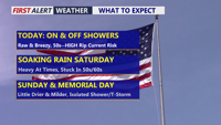
Delmarva will begin the holiday weekend with raw, breezy, and damp conditions today as spotty showers move across the peninsula. Temperatures will stay in the upper 50s to low 60s with east winds gusting up to 30 mph. A high rip current risk and cold ocean water will make beach and surf conditions dangerous today and tomorrow. Rain becomes steadier Saturday into Saturday night, with beneficial rainfall expected before showers taper Sunday. Memorial Day looks somewhat warmer, but showers may still linger at times.
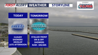
Delmarva’s record-breaking heatwave is over as a cold front stalls nearby, bringing cloudy, breezy and unsettled weather through Memorial Day. Periods of rain, cooler temperatures and elevated rip current risks are expected, though the rainfall will be beneficial amid ongoing severe drought conditions.
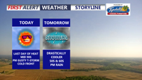
Delmarva will see one more hot and humid day today, with inland highs in the mid 90s and a third straight 90-degree day marking a heat wave. A strong cold front will bring showers and isolated severe thunderstorms late this afternoon and evening, followed by a much cooler, unsettled pattern through the end of the week and Memorial Day weekend.
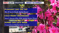
Delmarva will see a pleasant and mainly dry Tuesday with partly sunny skies and only a slight chance for an isolated shower or sprinkle. Temperatures will be mild inland, cooler along the coast, and partly cloudy skies continue tonight. Wednesday stays mild ahead of a strong cold front, with much-needed rain developing later in the day and continuing into early Thursday. A stronger thunderstorm cannot be ruled out, but the overall risk remains low.
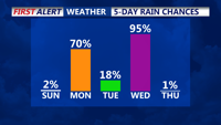
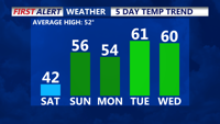
Today will see a warm-up, with temperatures climbing 10 to 15 degrees higher than Saturday, reaching the mid-to-upper 50s under mostly sunny skies. A warm front will bring increased moisture and cloud cover Sunday night. Rain is expected Monday and midweek as a strong cold front moves through, followed by colder, drier conditions Thursday and Friday.
High pressure will dominate into the weekend, but milder temperatures and increasing high clouds will take over Delmarva starting Saturday. A warm front is set to move in Saturday night, bringing changes into early next week, including periods of rain and a midweek cold front.
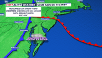
This weekend brings a noticeable cool down to Delmarva. High pressure builds in on Saturday, ensuring sunny skies but cooler temperatures struggling to get to 60. By Sunday, a warm front approaches, increasing clouds and bringing much-needed rain by late Sunday into Monday morning. Rainfall totals of 0.25-0.50 inches are expected, offering some relief to ongoing drought conditions. The week ahead looks dry and seasonable through midweek, with potential for a coastal low bringing more rain late next week.