


The dangerous cold stretch continues for Delmarva for the rest of the weekend and into the start of the new week.
From
To

The dangerous cold stretch continues for Delmarva for the rest of the weekend and into the start of the new week.

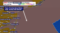
From early Saturday morning into Sunday morning, an arctic blast will bring potentially damaging wind gusts, life-threatening wind chills, and dangerous marine icing from Sussex County, Delaware, to Ocean City, Maryland

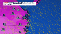
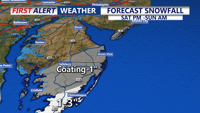
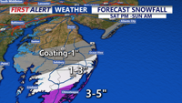
Light snow late Friday night is expected to be followed by high winds and life-threatening wind chills Saturday into early Sunday from Delaware’s beaches through Ocean City.

A cold stretch that turns downright harsh this weekend, with the biggest headline being dangerous wind chills and strong winds, not snow.

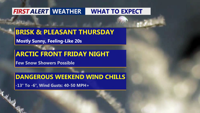
Delmarva stays sunny but cold today, then turns cloudier Friday ahead of a clipper and an arctic front. Snow looks minimal (if any, just a dusting), but a sharp temperature crash and powerful winds arrive Saturday—bringing dangerous wind chills into the single digits and potentially below zero.


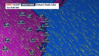
This morning wind chills could fall as low as 3 to 6 below zero, especially in more exposed locations.

Tonight brings yet another frigid, frosty night across the peninsula. Temperatures will tumble into the single digits, ranging from about 4 to 12 degrees by daybreak Saturday.

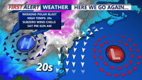
We continue to see a prolonged stretch of dangerous, potentially record-setting cold across Delmarva that will last through the remainder of the week and into the weekend.

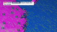
Bitterly cold out the door this morning with temperatures in the upper single digits and teens with feels like temperatures below zero in some locations.