


DELMARVA -- A cold stretch that turns downright harsh this weekend, with the biggest headline being dangerous wind chills and strong winds, not snow.

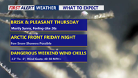
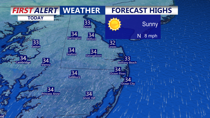
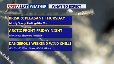
Wall-to-wall sunshine, brisk day on Delmarva with highs in the low 30s.
Expect wall-to-wall sunshine with afternoon highs in the low 30s. A north wind gusting up to 20 mph will keep it feeling more like the 20s for much of the day. Tonight skies stay mostly clear as temperatures drop back into the teens.
On Friday clouds increase ahead of an approaching clipper system and arctic front. Temperatures in the low to mid 30s, winds relatively calm. There’s a chance for snow showers, but confidence in accumulation is low—at most a dusting if a few showers manage to stick.
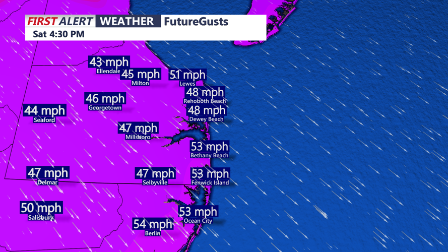
The weekend, is the main event. An arctic high building into the Great Lakes and Ohio Valley combines with low pressure over the Atlantic, tightening the pressure gradient and cranking up the wind. The warmest temperature may occur early Saturday, then readings crash into the teens by late morning. Northwest winds increase to 20–30 mph with gusts 40–50 mph, driving wind chills into the single digits, with some spots as low as -9.

Winds will be gusting 40-50 mph+ into Saturday afternoon-evening.
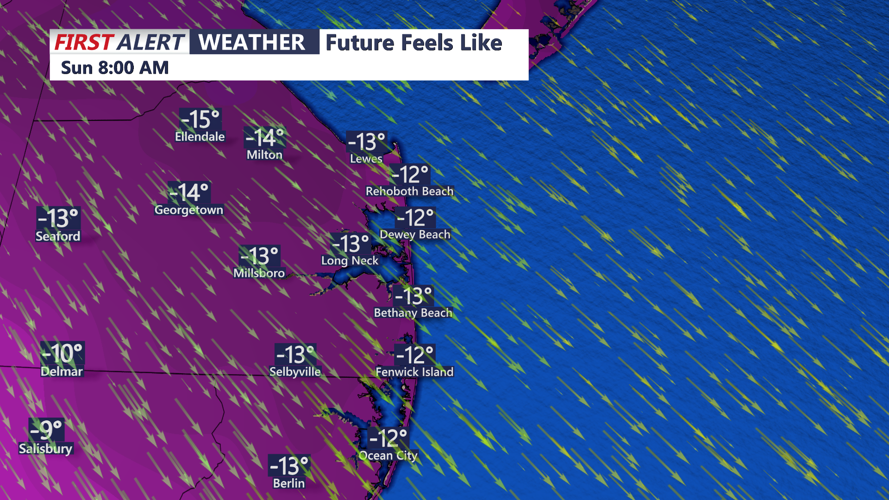
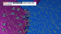
Saturday night into early Sunday winds ease slightly, still 15–20 mph with 25–40 mph gusts, but wind chills could plunge to -10 to -15 across much of Delmarva. Frostbite can occur with 15 to 30 minutes, so it's important to limit time outdoors and cover any exposed skin when being outside during the period where subzero wind chill values are forecast.

Dangerous wind chills develop Saturday afternoon-Sunday, wind chill values as low as -15 to 13 below zero.
Sunday arctic air hangs on with highs in the low 20s. Winds gradually diminish, but it will still feel like the single digits at times.
Temperatures begin a gradual warm-up above 40 degrees as the new work week progresses.
