


DELMARVA - Tonight brings yet another frigid, frosty night across the peninsula. Temperatures will tumble into the single digits, ranging from about 4 to 12 degrees by daybreak Saturday. With the breeze continuing, wind chills could fall as low as 3 to 6 below zero early Saturday morning, especially in more exposed locations. Cold Weather Advisories remain posted for all of Delaware and the northern Mid-Shore into Sunday morning, underscoring the risk for frostbite and hypothermia if you’re outside for extended periods.
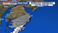
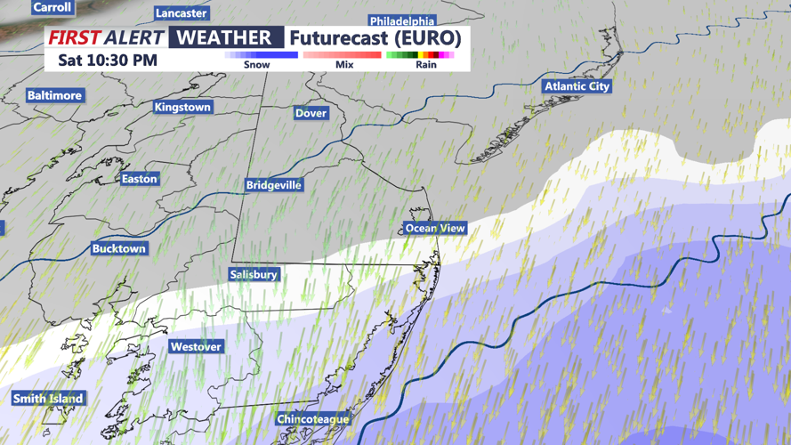
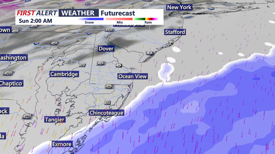
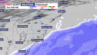
Saturday stays bone-chilling from start to finish, with highs again only in the low to mid 20s. Clouds will steadily increase ahead of a developing coastal storm, and light snow and flurries could develop, depending on the track of the storm. The coastal storm will rapidly deepen off the East Coast. While the storm should track far enough east to spare most of Delmarva from the most significant impacts, it is still close enough to bring hazards, especially near the coast.
The latest trend suggests the best chance for accumulating snow continues to focus farther south. Much of the area could miss out on the snow, with meaningful accumulations confined to the southern portion of the peninsula.
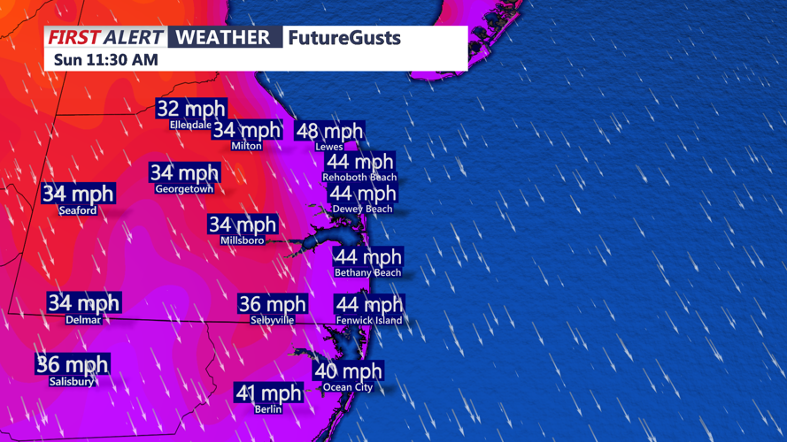
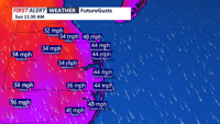
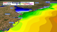
Even if inland locations avoid the worst, the coastline could see strong wind impacts and periods of rough conditions. Blistering wind chills Sunday and the threat of MINOR coastal flooding through high tide cycles Sunday and Monday. Higher than normal wave action 10'+, full moon, strong northeast winds.
Beyond the weekend, we’re watching another potential system for the middle of next week as a low pressure area passes south of the region. Some model guidance depicts development tied to a lee-side trough over eastern New Mexico and the Texas Panhandle that then progresses east across the Southeast and eventually offshore. As we’ve seen with recent systems, the exact track will matter a lot for Delmarva. A farther south track would reduce snow chances locally but could reinforce very cold air later next week, particularly Thursday and Friday. For now, a blended, middle-ground forecast points to a broad 20 to 40 percent chance for precipitation midweek, with temperatures running about 5 to 10 degrees below normal as the cold pattern continues.
Stay up to date on the approaching winter storm with radar and hourly forecasts in the CoastTV weather app, available for Apple and Android.