


Cloudy, cooler conditions will continue across Sussex County through Thursday before quieter weather returns Thursday night.
From
To

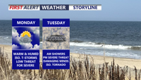
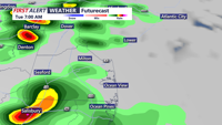
A warm and muggy Tuesday will bring multiple rounds of thunderstorms capable of producing damaging winds, torrential rainfall and localized flash flooding across Delmarva.

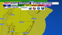
Scattered strong storms are possible across Delmarva today, but Tuesday is expected to bring the greatest threat for severe weather and flash flooding.

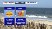
Refreshing air, sunshine and comfortable temperatures will give Delmarva one of its best stretches of summer weather through the weekend.

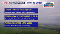
Damaging winds, torrential rain, isolated tornadoes and flash flooding are possible across Delmarva today and Wednesday.

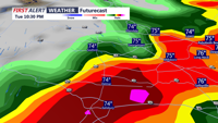
Rounds of thunderstorms could bring damaging winds and flash flooding from Tuesday morning through early Wednesday.

Multiple rounds of storms could bring damaging winds and flooding rain Tuesday.


Delmarva will enjoy one more pleasant and mostly sunny day Monday before humidity, showers and strong thunderstorms return Tuesday.

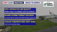
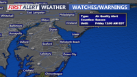
Code Red air quality will continue across Delmarva today as dense Canadian wildfire smoke lingers ahead of a stormy, hot and humid Saturday.

Wildfire smoke and dangerous heat will affect Delmarva today before a more widespread threat of severe storms and flash flooding develops Saturday.