


DELMARVA -- Today is a Red Alert Day across Delmarva as a dangerous mix of damaging winds, isolated tornadoes, heavy rain, and localized flooding develops ahead of a strong cold front moving through the region late this evening.
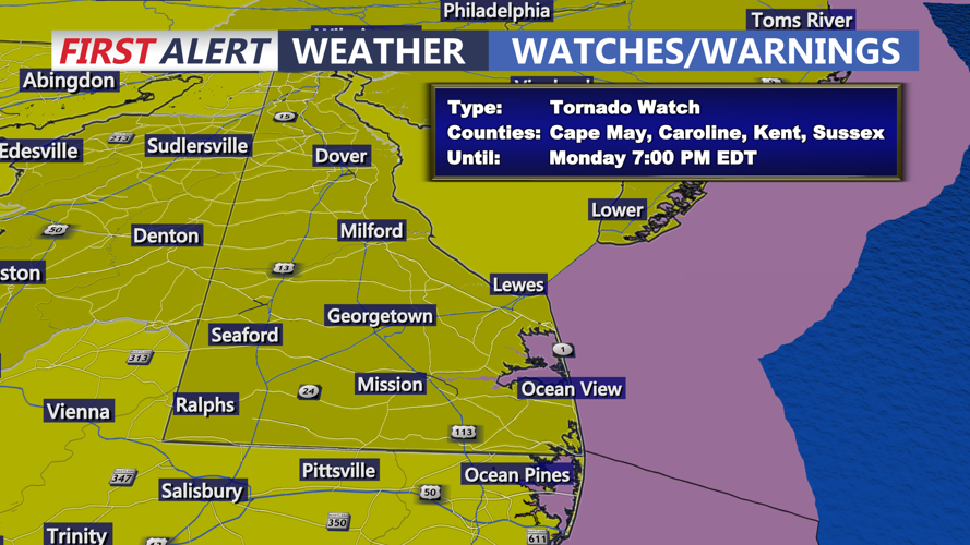
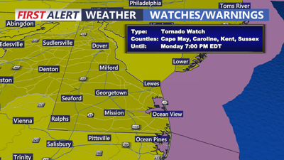
TORNADO WATCH is up for the entire Delmarva Peninsula until 7PM.
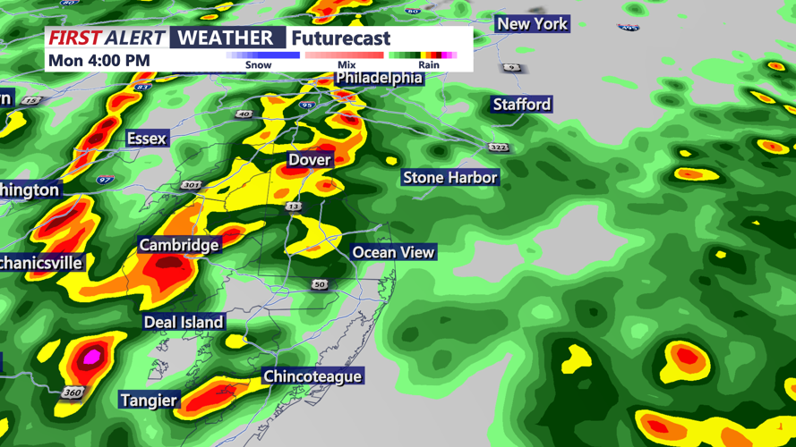
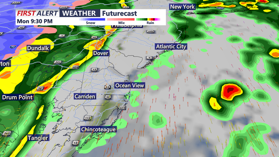
The First Alert weather team is closely tracking the potential for strong to severe thunderstorms from this afternoon through tonight as a strengthening storm system lifts from the eastern Great Lakes into southeastern Canada. This setup is pulling a deep plume of moisture northward into the Mid-Atlantic while a powerful upper-level jet and rapidly falling pressure provide strong atmospheric lift across the region. Scattered thunderstorms will develop this afternoon through the evening, followed by a squall-line between 9PM and 11PM this evening.

Severe storms could produce damaging winds 70 mph+ and brief tornadoes.
The greatest concern will be damaging wind gusts, but the tornado threat is also increasing. Low-level wind shear will be quite strong ahead of the cold front, and while instability remains somewhat limited for mid-March, the overall dynamics are strong enough to support organized severe weather. If temperatures and dew points rise more than currently forecast, instability could increase enough to allow isolated supercells to form ahead of the main line of storms this evening. That would raise the tornado risk even more.

After initial scattered storms early in the day a potent squall-line approaches late this evening bringing the threat of damaging winds.
The tornado potential appears most supportive of quick spin-up tornadoes embedded within a line of storms, often referred to as QLCS tornadoes. These can be brief and difficult to warn for, making today’s setup especially concerning. The Storm Prediction Center continues to place the area in an enhanced risk for severe weather. Highest tornado risk is on the Mid-Shore.
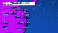
Even outside of thunderstorms, strong southerly winds will create hazardous conditions across Delmarva. Gusts of 35 to 45 mph are expected this afternoon into tonight, with localized gusts near 50 mph possible. A Wind Advisory has been expanded to include most of the area. These winds will also push in an unusually warm and humid air mass, sending temperatures into the mid 60s to low 70s inland, while coastal communities remain closer to 60 degrees.

Non-thunderstorm gusts will exceed 45 mph+ late this afternoon-evening.
In addition to the wind and tornado threat, periods of heavy rainfall could lead to localized flash flooding, especially in inland areas. Along the coast, Sussex County is under a Coastal Flood Advisory as strong southerly winds are expected to cause minor tidal flooding along the back bays. The most vulnerable locations include Rehoboth Bay and Little Assawoman Bay, where water can become trapped during strong southerly wind events and fail to drain properly around low tide.

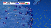
Behind the front turns cold and blustery with lows in the upper 20s to low 30s by Tuesday morning.
Once the cold front moves through, it's a return to winter-like temperatures. A much colder air mass will settle in for Tuesday and Wednesday. Dry weather and mostly sunny skies are expected, but it will turn sharply cooler with highs mainly in the mid 30s to mid 40s. Gusty post-frontal winds up to 30 to 35 mph will remain possible Tuesday. Conditions then begin to moderate later in the week, with the next chance for showers arriving Friday night into Saturday.
