


DELMARVA - High pressure will dominate the region through Thursday night, keeping skies clear and winds light. Temperatures will dip overnight, with frost possible in some inland areas. By Friday, the high will slide offshore, allowing winds to shift from the southeast and temperatures to gradually rise into the upper 60s to low 70s.
Clouds will begin to increase Friday night as a developing coastal low approaches from the south. Forecasters expect the cloud cover to prevent additional frost or freeze concerns overnight.
Saturday will bring mostly cloudy to overcast skies, with highs again in the upper 60s to low 70s. Most of Sussex County should stay dry during the day, but rain is forecast to spread into coastal areas by afternoon. Winds from the east will strengthen later in the day, signaling the storm’s arrival.
Conditions are expected to deteriorate rapidly Saturday night as rain overspreads the region. Forecasters estimate a 60% to 80% chance of rain across the area, with the heaviest rainfall expected over lower Delmarva. Coastal wind gusts could reach 40 to 50 mph by early Sunday morning.
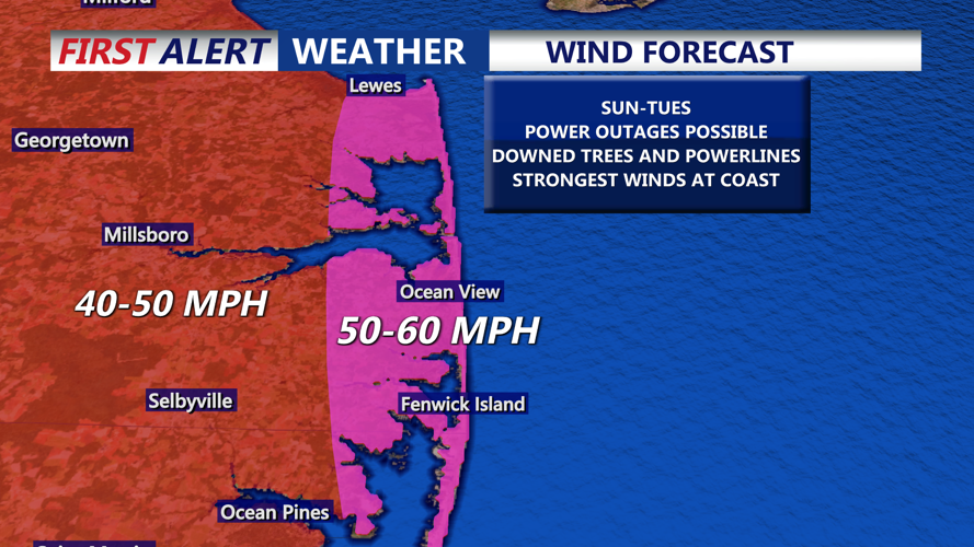
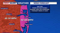
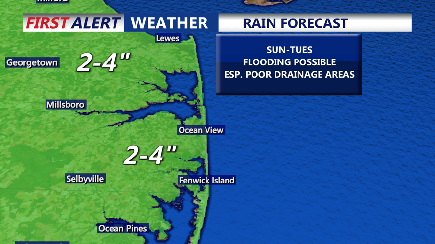
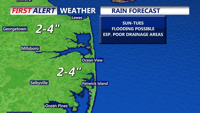
The storm is expected to intensify near the North Carolina coast and move northward Sunday into early next week. Sussex County could face strong, potentially damaging winds — sustained at 30 to 40 mph with gusts near 60 mph along the coast — as well as widespread rain totaling 1 to 3 inches, with locally higher amounts possible.
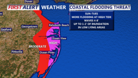
A heightened risk of coastal flooding, beach erosion and dangerous marine conditions. A High Wind Watch is already in effect for coastal Delaware, with additional advisories likely as confidence in the storm track increases.
Conditions are expected to improve by Tuesday as the storm moves away, bringing drier weather and more seasonable temperatures for mid-October.
