


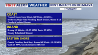
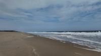
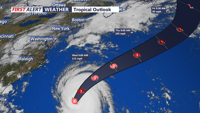
Hurricane Erin will pass offshore this week, but its growing size is already producing dangerous waves and life-threatening rip currents along Delmarva beaches. Tropical Storm Warnings remain in effect from the coastal waters of Cape Henlopen to Chincoteague, with strong winds and minor to moderate tidal flooding expected Thursday. Conditions begin to ease by Friday as high pressure builds in.
From
To

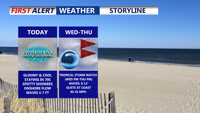
High pressure to the north and a stalled boundary to the south will keep Delmarva cloudy, cool, and unsettled through midweek. Hurricane Erin will make its closest pass offshore Thursday, bringing dangerous rip currents, high surf, and gusty winds along the coast. Inland areas will see scattered showers and below-normal temperatures before calmer, drier weather returns late week.

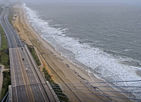
Cape Henlopen State Park announced Tuesday morning that all surf fishing drive-on crossings and swimming beaches are temporarily closed due to high surf and unsafe conditions, park officials announced.

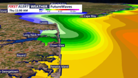
From Slaughter Beach to Ocean City, residents are bracing for dangerous surf, coastal flooding, and gusty winds as Hurricane Erin churns offshore.

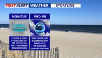
A stalled cold front south of Delmarva will bring sharply cooler, breezy conditions Monday, with highs only in the 70s under mostly cloudy skies with some showers possible. High pressure from the north will reinforce the cool pattern through midweek, while Hurricane Erin remains offshore but creates coastal hazards including high surf, rip currents, and possible flooding.


Delmarva will notice a big change in the weather starting Sunday night as a cold front sweeps across the region. The front is expected to pass from northwest to southeast late Sunday evening into the overnight hours, followed by a shift in winds from the southwest to the north and northeast. Low clouds are likely to form, with overnight lows dropping into the upper 60s to lower 70s by Monday morning.

High surf closes beaches, medical waste washes ashore a no swim advisory in effect.

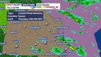
Several advisories are on the radar for the upcoming forecast, including wind and floods.

REHOBOTH BEACH, Del. - Rehoboth Beach is gearing up for the impacts of Hurricane Franklin, currently positioned hundreds of miles offshore in …