


DELMARVA - Beaches along the Delaware and Maryland coast are already feeling the power of Hurricane Erin. Rehoboth Beach and Dewey Beach closed access to the ocean Monday as waves grew stronger, rip currents intensified, and lifeguards warned conditions were too dangerous for swimmers. Officials described the surf now as only a preview of what’s expected later this week.
According to the National Hurricane Center’s 8 p.m. update, Erin remains a powerful Category 4 hurricane with sustained winds of 130 miles per hour. The storm is moving northwest and is expected to track between Bermuda and the East Coast by midweek. While Erin’s center will stay offshore, its massive wind field is sending dangerous swells hundreds of miles toward the coastline.
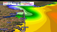
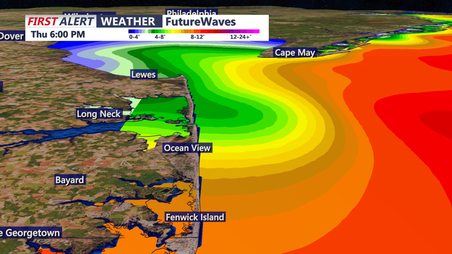
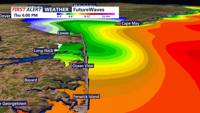
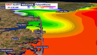
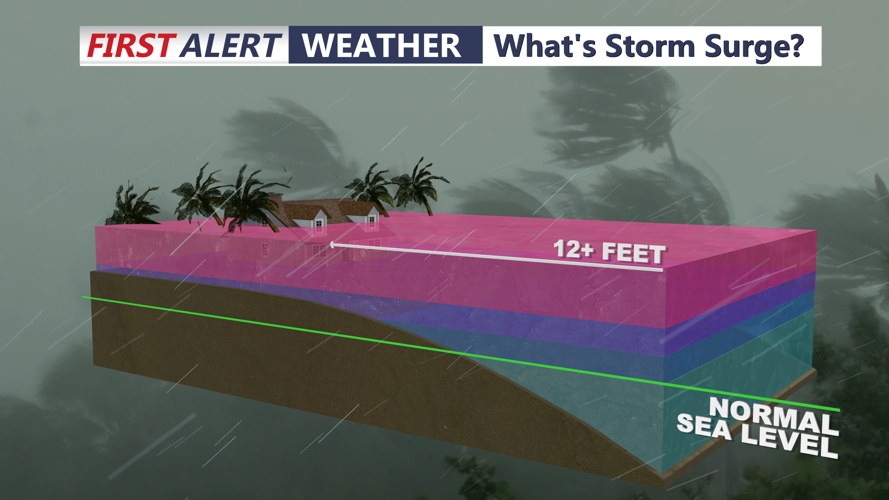
The biggest threats for Delmarva will come from the water. Large, long-period waves are forecast to grow throughout the week, leading to beach erosion, life-threatening rip currents, and the possibility of storm surge flooding during times of high tide. Coastal communities from Slaughter Beach south through Ocean City should prepare for breakers topping 10 feet by Thursday. Offshore waves may be more than twice that height.
By Thursday evening, gusty winds will add to the hazards. Forecasters expect wind gusts along the Sussex County shoreline to easily reach 45 miles per hour, driving water inland and worsening coastal flooding in low-lying areas.
Local emergency managers are urging residents to monitor forecasts closely and to avoid entering the water for the next several days. Even skilled swimmers are at risk in these conditions, as currents can pull far from shore in seconds.
Key points:
Beaches already closed Monday in Rehoboth and Dewey because of high surf.
Erin remains a major Category 4 hurricane offshore.
Dangerous swells, rip currents, and storm surge are the main threats to Delmarva.
By Thursday evening, winds may gust up to 45 miles per hour along the Sussex County shore.
