


DELMARVA -- High pressure retreating over New England and the approach of Hurricane Erin are shaping up to bring unsettled weather and dangerous coastal conditions to Delmarva through Thursday.

Mostly cloudy skies, highs in the low 80s, isolated showers and t-storms are possible.
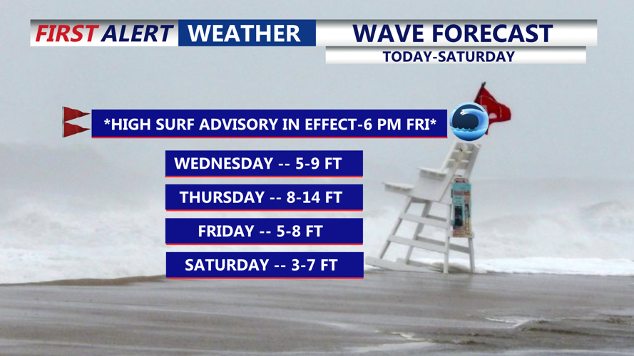
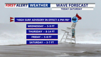
Wednesday will be mostly cloudy, with highs ranging from 78 to 84 degrees. Breaks in the clouds may allow for a few isolated showers or thunderstorms during the afternoon. The bigger concern is offshore, where Hurricane Erin is churning northward. Dangerous waves between five and eight feet are already battering area beaches, creating life-threatening rip currents.
Wednesday night will stay mostly cloudy and breezy with lows near 70. Winds from the northeast at 15 to 25 mph could gust up to 30 mph.
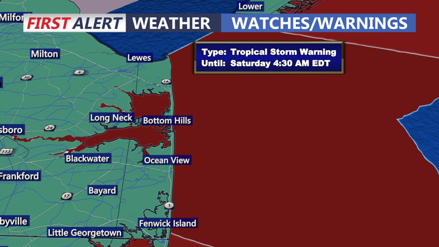
The storm is forecast to make its closest approach late Thursday, passing 350 to 450 miles southeast of Delmarva. While Erin’s center remains offshore, its expanding wind field will still impact the region. Tropical Storm Warnings are in effect for coastal waters stretching from Cape Henlopen, Delaware, south through Ocean City, Maryland, and down to Chincoteague, Virginia.

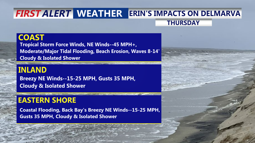
Tropical storm warning for the coastal waters of the Delmarva coast Thursday.
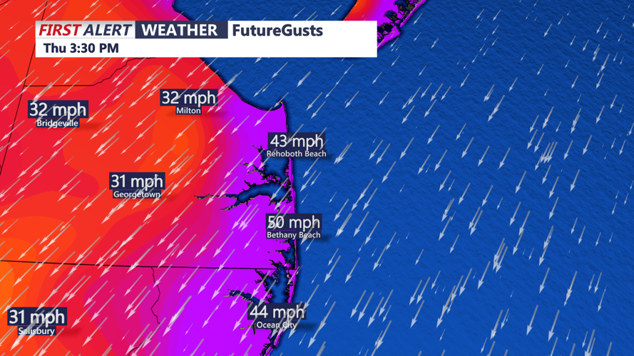
Gusty northeast winds will develop Thursday, with inland gusts reaching 30 mph and coastal gusts potentially up to 50 mph.

Gusts out of the northeast Thursday as high as 50 MPH at the coast, inland gusts 30-35 MPH.
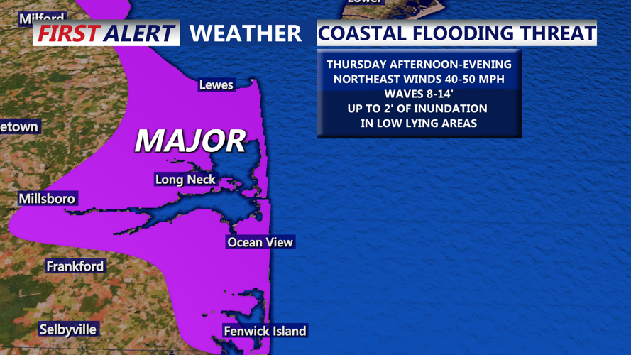
A Wind Advisory is posted from 10 a.m. to midnight Thursday. Coastal flooding, high surf, and significant rip current risks are likely, with moderate to major tidal flooding expected during high tide Thursday evening.

Major tidal flooding is possible Thursday afternoon-evening, strong northeast winds with high wave action could yield of to 2' of inundation in low lying areas.
Beach erosion is likely. Rainfall will remain light, with only isolated showers or downpours.

Breaking waves will peak at 14' on Thursday as Erin makes the closest approach to Delmarva.
Conditions will gradually improve Thursday night as Erin tracks farther out to sea. Skies will begin to clear, and winds will ease overnight, with lows falling into the upper 50s to low 60s.
Friday will bring a return to calmer weather, with high pressure building in. Skies will be mostly sunny, and highs will range from the upper 70s to low 80s. Despite the sunshine, rough surf and elevated seas will persist.
Looking ahead, Saturday remains pleasant with highs in the low to mid-80s under partly to mostly sunny skies. A system approaching from the Great Lakes will bring shower and thunderstorm chances late Saturday night into Sunday. A cold front is expected to move through early next week, ushering in drier and more comfortable conditions by Tuesday.