


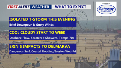
DELMARVA -- Will notice a big change in the weather starting Sunday night as a cold front sweeps across the region. Can't rule out a brief gusty thunderstorm this evening as a cold front pushes through the region. The front is expected to pass from northwest to southeast late Sunday evening into the overnight hours, followed by a shift in winds from the southwest to the north and northeast. Low clouds are likely to form, with overnight lows dropping into the upper 60s to lower 70s by Monday morning.
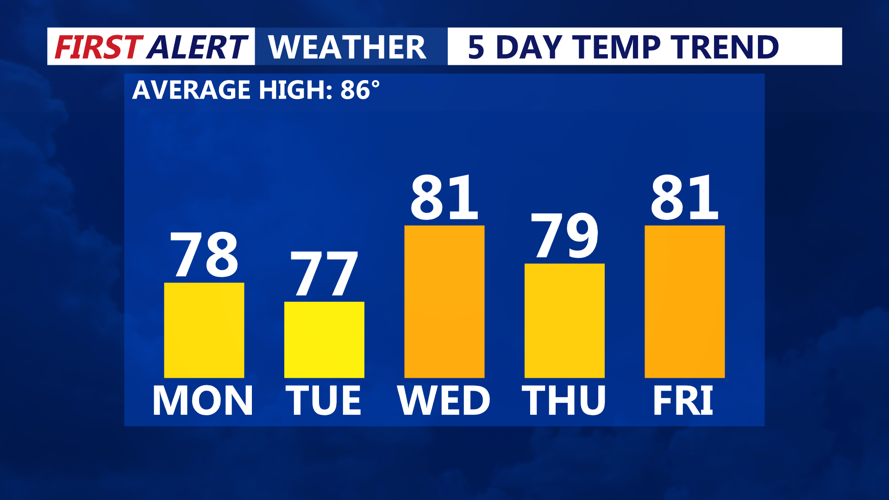
The start of the workweek will bring much cooler conditions compared to Sunday. Highs Monday will struggle to rise out of the 70s under mostly cloudy skies as northeast winds persist. A stalled front to the south may keep a few spotty showers and t-storm around, but the main story will be the noticeably lower temperatures and humidity.

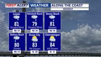
A lot of clouds Monday, especially along the coast, southern DE, better chance for sun would be Eastern Shore and southern areas. Isolated showers & t-storm.
Cooler weather will hold through midweek as high pressure builds in from the north. Overnight lows Monday and Tuesday nights will dip into the mid to upper 60s, with daytime highs Tuesday also in the mid-70s. While a stalled boundary nearby could still trigger an isolated shower, widespread rainfall is not expected.

By Wednesday, shortwave energy approaching from the west may bring additional chances for showers or an isolated thunderstorm, while temperatures remain below seasonal norms.
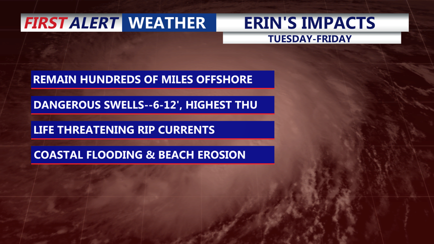
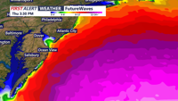
Farther offshore, Hurricane Erin is forecast to pass well east of the Mid-Atlantic coast, but its impacts will be felt along Delmarva’s beaches.

Impacts will be felt as early as Tuesday in the form of increasing wave heights, highs waves will be Thursday.
The prolonged onshore flow and large ocean swells are expected to create dangerous rip currents, high surf, the risk of beach erosion, and possible coastal flooding through the week. The National Hurricane Center continues to monitor the storm.

Swells will peak Thursday along the Delmarva coast as high as 12'.
High pressure should bring calmer and drier weather toward the end of the week, with seasonable conditions returning. Another round of unsettled weather could approach the region by next Sunday.