




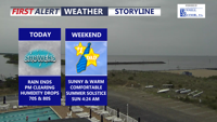
After morning rain, Delmarva will enjoy clearing skies, lower humidity, and comfortable temperatures to end Friday. The weekend looks mostly sunny and pleasant, with seasonable warmth and low humidity for outdoor plans and Father’s Day. A more unsettled pattern returns Monday with widespread rain and some thunderstorms possible.
From
To


Delmarva will enjoy a pleasant Friday with partly cloudy skies, lighter northeast winds and cooler temperatures compared to Thursday. Temperatures will range from the low to mid 60s at the beaches to the 70s inland, with some lower shore communities nearing 80 degrees. A spotty shower is possible Friday evening into the overnight, but the bigger change arrives this weekend as low pressure brings widespread rain, chilly temperatures and breezy coastal conditions. Rainfall totals from Friday night through Sunday may reach half an inch to slightly over an inch inches across the area, providing beneficial rainfall despite the soggy weekend.

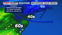
Patchy fog and drizzle early Thursday should gradually transition to periods of steadier rain Thursday night into early Friday, with mainly wet — not wintry — impacts expected in Sussex County.

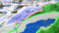
A calm early Friday will shift toward a wintry setup as a developing system brings the potential for accumulating snow Saturday night into early Sunday.


Delmarva stays cloudy but dry today with highs in the 50s; rain arrives Friday night before cooler, brighter conditions return for the weekend.

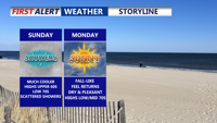
Clouds and scattered showers linger across Delmarva Sunday as a nearly stationary front and weak low pressure system pass through the region. Highs will remain cool, in the low 70s, before conditions clear late in the day. Dry weather and seasonable temperatures return Sunday night into Monday, with partly sunny skies and highs in the mid-70s. A weak coastal low could increase cloud cover Tuesday into Wednesday, followed by a stretch of dry, pleasant weather for the latter half of the week.

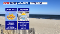
Monday will bring sunny skies and highs in the low 80s with comfortable humidity across Delmarva. However, haze from Canadian wildfire smoke may filter the afternoon sunshine. Delaware is under a Code Orange Air Quality Alert, posing health risks to sensitive groups, and there’s a moderate rip current risk at area beaches. Tranquil and dry weather continues into Tuesday before cloud cover increases midweek with near-normal temperatures and a slight chance of showers later in the week. Watching the coast late week for a potential develop coastal low.


Delmarva begins the week with damp, gray skies and cooler temperatures, but change is on the horizon. After periods of drizzle and light showers Monday and Tuesday, warmer and more humid air arrives midweek. By Thursday, temperatures could soar into the 90s with strong to severe storms possible as a cold front sweeps through. The weekend looks drier and more comfortable with sunshine and highs in the 80s.

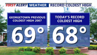
Father’s Day on Delmarva was one for the weather record books—Georgetown set a new daily cold high mark of 68°F, the third chilliest Father’s Day on record. Overcast and cool conditions linger through Monday with scattered drizzle and showers possible. A slow transition to a warmer and stormier pattern begins Tuesday, peaking Thursday with near-record heat and a risk of severe storms. Cooler, more settled weather returns for Friday and the weekend.

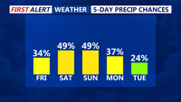
From early Friday through early Sunday, Sussex County will experience waves of showers and possible thunderstorms with high humidity and a low-end flood threat.