


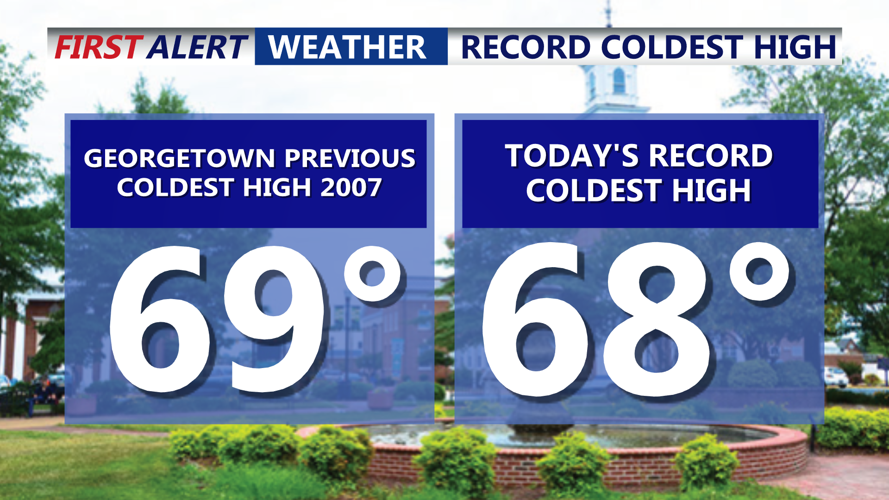


DELMARVA -- It was a cool and gloomy Father’s Day across Delmarva, but at least it stayed dry. While families across the region celebrated the holiday under overcast skies, Georgetown set a new weather milestone, recording a high of just 68 degrees.

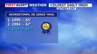
With Sunday record, we now crack the top 3 coldest highs ever recorded for Father's Day.
This temperature not only broke the daily record for the coldest high on June 15—previously 69 degrees set in 2007—but also ranked as the third coldest Father’s Day high ever observed in the area. Only 1999 (65°F) and 1984 (67°F) were chillier.
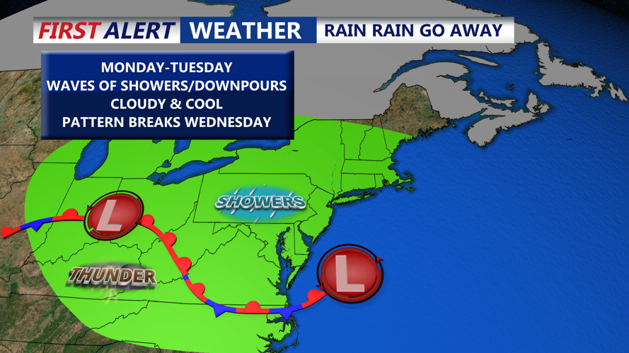
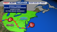
That cool trend continues into the start of the workweek as a weak low-pressure system tracks along a stationary front over the Mid-Atlantic Sunday night into Monday. While rainfall will be scattered and difficult to pinpoint, mist, drizzle, and periods of light showers are expected through Monday morning. Rain chances range between 30% and 60% tonight, tapering to 20%-30% by Monday, with total precipitation expected to stay under a tenth of an inch for most, though isolated higher amounts are possible.

Cloudy and unsettled through Tuesday with a few more waves of showers and downpours.
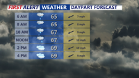
Overnight lows will hover in the low to mid-60s, while Monday’s highs reach into the upper 60s to low/mid 70s.

Showers and damp start to Monday, cloudy and cool with highs near 70.
The dreary pattern holds steady into Tuesday as the boundary lifts north as a warm front. A couple of rounds of rain are expected—first late Monday night into Tuesday morning, then again Tuesday night into early Wednesday. Tuesday temperatures will edge higher, reaching into the upper 70s to near 80.
By Wednesday, the warm front will be north of the area, ushering in warmer, more humid air. Highs climb into the upper 80s to near 90, with continued chances for scattered showers and thunderstorms thanks to a series of upper-level disturbances.
Looking ahead, a significant warm-up is in store. Thursday brings peak heat with highs in the low 90s and dew points in the low 70s, pushing heat index values into the upper 90s. The Storm Prediction Center has placed parts of the Northeast and Mid-Atlantic under a 15% risk for severe weather on Thursday, with the potential for strong to severe thunderstorms as a cold front moves through late in the day.
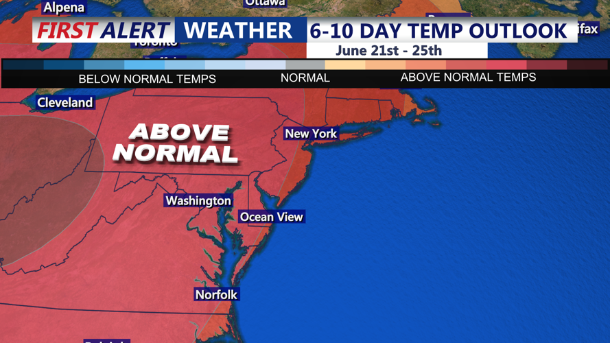
Relief arrives Friday and Saturday as high pressure builds in, lowering humidity and stabilizing conditions. Highs will settle into the low to mid-80s with mostly sunny skies, though an upper trough Friday could bring isolated showers across northern Delmarva. The weekend should remain pleasant with another potential front arriving on Sunday. Looking at the extended forecast we could see our first heatwave of the season between June 23rd through the 29th.

Back into the 90s midweek, then our first heatwave of the season is possible June 23rd - 29th.