


DELMARVA - People are expected to wake up to another damp, low-visibility start Thursday, with patchy fog, mist and occasional drizzle lingering into the morning hours before a stronger round of rain arrives late Thursday night into early Friday.
Expect the murky conditions to hang on through the early part of the day as a stalled front remains nearby, trapping low clouds close to the ground. Visibility could vary widely from town to town, especially around daybreak, and roads may stay slick from drizzle even where rainfall is light.
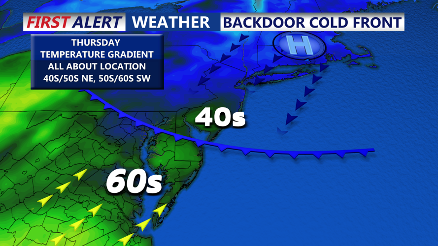
By Thursday afternoon, temperatures should rebound into the 40s, but skies are likely to remain mostly cloudy. Any breaks in the fog may be temporary, and some lingering mist is possible.
The bigger change is expected Thursday night as a low-pressure system approaches, bringing a more organized period of rain into the region. The steadiest rainfall is anticipated overnight into early Friday, potentially totaling around a half-inch in spots, with wet roads and ponding in poor-drainage areas possible during heavier bursts.
We are tracking a risk of wintry mix and icing farther north and west of Delmarva, it is expected to stay mainly rain through early Friday given temperatures above freezing.