




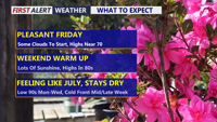
Delmarva will enjoy a mostly sunny and pleasant Friday with highs in the upper 60s to low 70s before a warming trend takes hold this weekend. Temperatures will climb into the upper 70s and low 80s Saturday, then surge into the mid 80s to low 90s from Sunday through the middle of next week. Mostly dry weather is expected through the next several days, though isolated showers or storms are possible Sunday and a better chance of showers and thunderstorms arrives late Wednesday into Thursday as a cold front brings temperatures closer to normal.
From
To

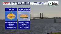
Delmarva will enjoy a sunny and comfortable day today with highs near 70 as high pressure settles in. Breezy and milder conditions arrive tonight into Wednesday, with temperatures climbing into the 70s before a cold front brings showers and a few possible thunderstorms Wednesday night into Thursday morning. After the system moves away, much warmer air builds in for the weekend and early next week, with widespread 80s and a few inland spots possibly reaching 90 by Monday.

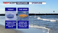
Today brings a pleasant and mild start to the week across Delmarva with mostly cloudy skies, breezy southwest winds, and highs near 80 inland, while beach communities stay in the mid to upper 70s. A weak disturbance could spark an isolated light shower, mainly north and west of the peninsula. Warmer air then builds in through midweek and into the weekend, sending temperatures 15 to 30 degrees above average with some inland spots potentially reaching 90 degrees for the first time this year.

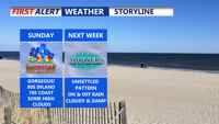
High pressure brings warm, dry weather to Delmarva on Mother’s Day, with highs in the low 80s inland, 70s at the coast. Clouds and rain chances increase Monday night through Wednesday as a Gulf Coast low moves in, followed by a warmer, unsettled end to the week.

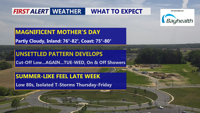
The Delmarva Peninsula will enjoy a warm and dry Mother’s Day under high pressure, but weather conditions will shift by midweek as a low-pressure system brings increasing clouds and rain chances. Expect highs near 80 degrees Sunday before a gradual cooling trend sets in with scattered showers through Thursday.

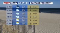
Delmarva will wrap up the weekend with above-average warmth Sunday, but a strong cold front Monday night will bring the threat of severe storms and heavy rainfall. Cooler, breezy conditions return Tuesday, with a more unsettled pattern setting up for the latter half of the week.

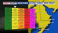
After an unseasonably warm weekend, Delmarva will experience a sharp weather shift as a strong cold front moves in Monday night. Slight risk for severe thunderstorms and heavy rain. Cooler, drier air returns Tuesday before another unsettled pattern arrives late week.

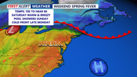
Delmarva will enjoy the warmest weather of the year so far this weekend, with highs reaching into the 80s on Saturday ahead of a backdoor cold front. The front will bring increased clouds and slightly cooler temperatures Sunday into Monday, though highs will still reach the 70s. A strong cold front Monday evening brings a slight risk of severe weather, followed by a return to cooler and drier conditions Tuesday. Another system may bring clouds and rain late next week, with temperatures fluctuating once again.

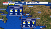
Delmarva will enjoy warm and mostly dry conditions this weekend, with highs in the mid-80s on Saturday. Rain chances increase late Sunday night as a system approaches from the north, but significant impacts are unlikely.