Storyline

Terrific Tuesday, milder Wednesday with a chance for showers and storms late Wednesday evening.

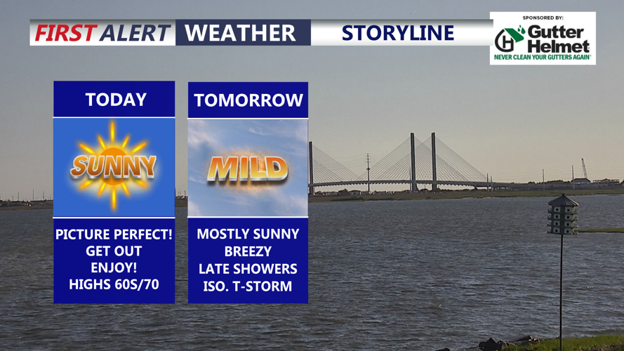
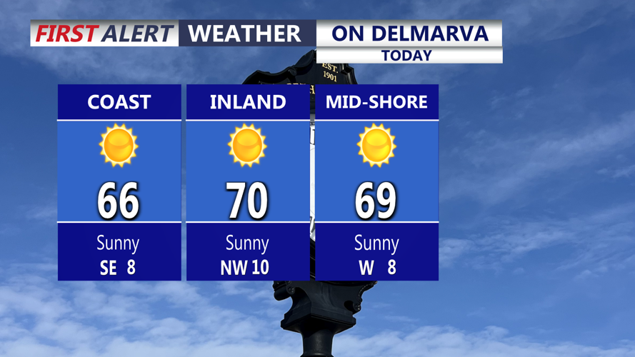
DELMARVA -- A picture perfect day is on tap across Delmarva today as high pressure moves into the region. Sunshine will dominate the forecast, with afternoon highs reaching the upper 60s to around 70 degrees. It will be a pleasant and comfortable day from the beaches to inland communities.

On Delmarva

Wall-to-wall sunshine, absolutely beautiful day on tap!

Tonight will remain mostly clear, but a breeze will develop and temperatures will not be as chilly as recent nights. Overnight lows will settle into the upper 40s to lower 50s across Delmarva.

Rain Chances Next 7 Days

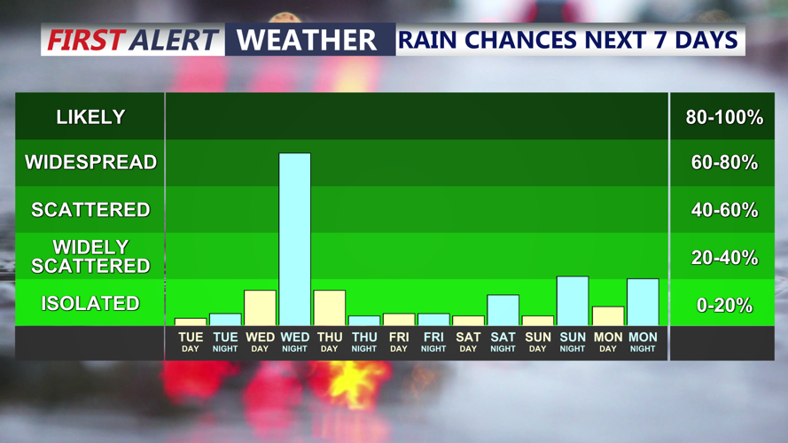
Scattered showers and a thunderstorm possible Wednesday night. 

Wednesday will bring a noticeable warmup as southerly winds increase ahead of an approaching cold front. Skies will be mostly sunny for much of the day, with highs climbing into the mid to upper 70s. It will also turn breezy, with south wind gusts potentially reaching up to 40 mph at times.

Get our all-good news weekly newsletter
FEEL GOOD FRIDAY

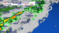
Clouds and shower chances will increase from west to east later Wednesday afternoon and especially Wednesday night as an upper-level trough moves into the Eastern United States. This system is expected to develop into a closed low over the Mid-Atlantic and Northeast by Thursday, helping to bring a round of showers to Delmarva as a cold front arrives.

Showers are likely Wednesday night, and a few thunderstorms cannot be ruled out. Any thunderstorm activity will depend on how much instability develops ahead of the front. At this point, the greatest risk for stronger storms appears to remain well west of Delmarva, with instability locally expected to stay limited due to the later arrival of the showers. 

Futurecast

Broken line of showers and a rumble of thunder pushes through Wednesday night into early Thursday morning. 

Some showers may continue into Thursday morning before the main forcing shifts offshore. However, with colder air aloft associated with the upper-level low, a few additional showers could redevelop during the day Thursday before the system fully departs the region. Rainfall totals are expected to remain on the lighter side, generally between 0.20 and 0.50 inches, though locally higher amounts will be possible where heavier showers or thunderstorms occur.

Conditions will improve heading into Friday and Saturday as the closed low lifts away and a ridge begins to build across the East. High pressure offshore will help bring in a much warmer air mass on southerly flow.

By Saturday, highs across Delmarva will reach the 70s to lower 80s. Sunday looks even warmer, with widespread 80s expected inland. Coastal areas will stay cooler thanks to the southerly wind component off the water.

The warmth continues to build into early next week. Monday is expected to bring highs in the 80s across much of Delmarva, with some inland areas possibly reaching 90 degrees. Beaches and coastal communities should remain cooler, but the overall pattern points toward very warm to potentially hot conditions for the region.


Meteorologist

Chris Mastrobuono is a South Philly native, but has come to join the CoastTV meteorology team. With over three years of experience delivering accurate, passionate and insightful weather analysis, he is eager to report on the coast. Previously, he spent over two years as a morning meteorologist at WEVV CBS/FOX in Evansville, Indiana. 

Recommended for you