


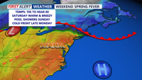


DELMARVA -- We are in for a taste of summer this weekend before a series of weather systems brings temperature swings and a chance for storms early next week.

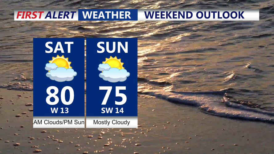
Highs Saturday soaring to 80 in many interior Delmarva locations.
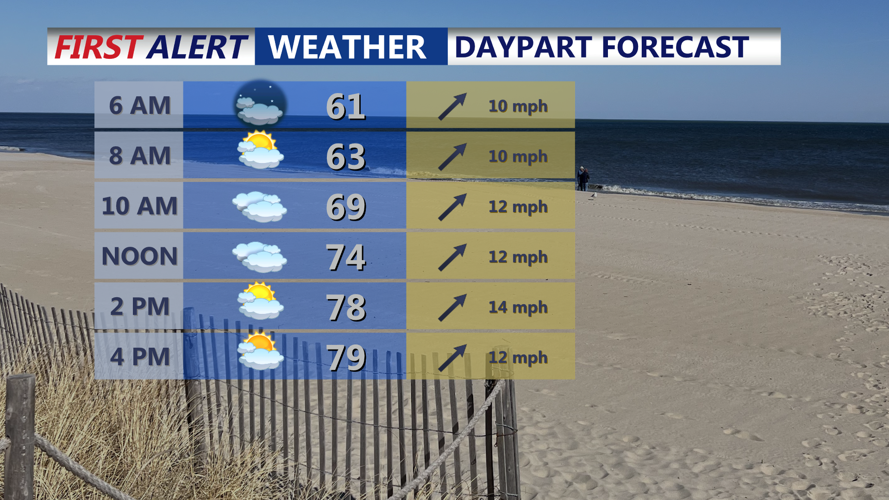
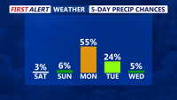
Saturday will be the warmest day of the year so far for many across the region. A warm front stalling to the northeast will allow a broad area of warm air to overspread Delmarva. Highs are expected to climb to around 80 degrees — possibly higher away from the coast where highs will be in the low 70s. Breezy southwest winds could gust up to 30 mph.
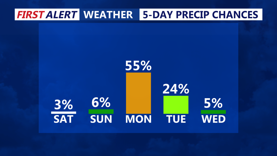
By Saturday night, a backdoor cold front is expected to slide southwestward into the region as strong high pressure builds over southeastern Canada. This will bring slightly cooler conditions and the chance for a few spotty showers, drizzle, or mist overnight. However, Delmarva’s overnight lows will remain mild, staying near 60 degrees.

Highs in the upper 70s to low 80s this weekend.
Sunday’s forecast is somewhat uncertain due to the placement of the front, which may stall across the area. Temperatures could vary depending on its exact location, but most of Delmarva should still see highs in the mid 70s under mostly cloudy skies. Precipitation chances will be low, with any significant weather remaining north and west of the region.
By Sunday night into Monday morning, warmer air surges back in from the southwest, pushing the stalled front out of the area. Expect overnight lows in the 50s to near 60 and highs on Monday again reaching the 70s — though not quite as warm as Saturday.

Looking at a mainly dry weekend, storms possible Monday night.
A strong cold front is expected Monday evening, with Delmarva remaining in a potential risk for strong to severe storms. Though recent forecast trends show the front slowing slightly, which could reduce the storm threat, forecasters still expect strong dynamics in play. Storms are most likely in the evening hours before cooler air moves in overnight.
Tuesday will feel much different, with highs dropping back into the 50s and brisk conditions under high pressure. A cold Canadian air mass settling in Tuesday night could bring temperatures near freezing inland.
Wednesday will begin with some sunshine, but clouds will increase ahead of the next system. A pair of low-pressure systems could bring rain and cloudy skies Thursday into Friday. While timing remains uncertain, temperatures are expected to rebound into the 70s during the day with lows around 50 at night as another warm front lifts north.
