


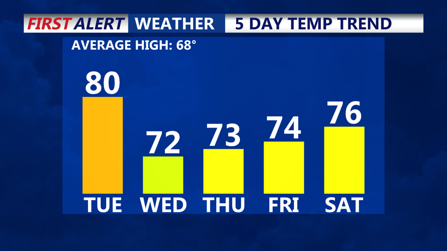


DELMARVA- It will feel more like June this afternoon, instead of April, as temperatures climb into the low 80s at inland locations, with 60s and 70s at the beaches.
Tuesday night brings calmer winds and the potential for some mid and high-level clouds, especially to the north. Lows will dip into the 50s across the region.
Wednesday is shaping up to be one of the nicest days of the week. With high pressure regaining control, mostly sunny skies are forecast and slightly cooler air will settle in. Highs should range through the lower 70s inland, with coastal areas staying in the 60s due to the influence of cooler marine air. Wednesday night will be quiet and cool again, with lows in the 40s and 50s.
For Thursday and Friday, the dry trend with high pressure still dominant. A slight warming trend begins inland, where highs will reach the low to mid 70s, while coastal locations remain more seasonable, the 60s for highs. Lows Thursday night will be in the upper 40s and low 50s.
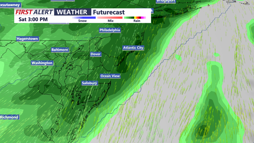
The next potential weather maker arrives on Saturday as a low-pressure system and frontal boundary slowly push across the region. Forecast confidence remains low regarding the exact timing and severity of this system, but rain appears most likely for Saturday. There is a slight chance of thunderstorms, although marine air could dampen instability. Temperatures will top out in the 70s on Saturday. Drier and cooler for Sunday with temperatures in the 60s.
