


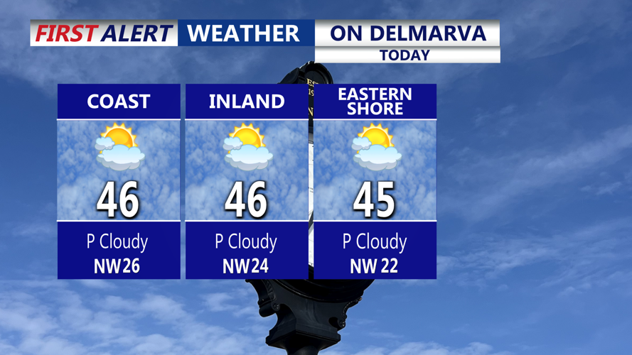


DELMARVA -- An arctic cold front will cross Delmarva this afternoon, bringing partly cloudy skies and a noticeable increase in northwest winds as colder air surges into the region. Gusts are expected to reach 25 to 30 mph, making Thursday’s mid- to upper-40s temperatures feel significantly colder.

Partly cloudy skies, chilly dry afternoon, arctic front brings in colder air tonight, winds will gust to 25 mph ahead of the front.
Behind the front, temperatures will drop sharply tonight, falling into the low to mid-20s across the Peninsula. By Friday morning, the center of an arctic high will be positioned over the lower Hudson Valley before shifting offshore during the afternoon. Meanwhile, an upper-level impulse will move in, helping a developing coastal low near Cape Hatteras track east-northeast into the western Atlantic.
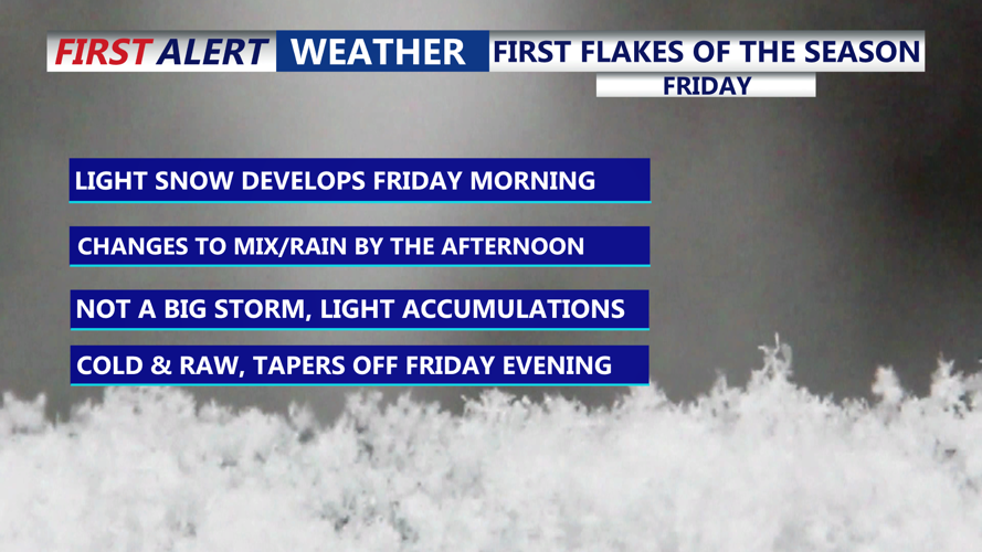
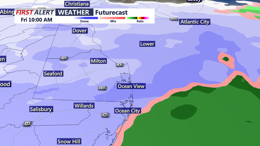
Light snow is expected to begin around daybreak Friday as temperatures remain below freezing. Slick conditions are expected through late morning. As highs slowly climb into the mid to upper 30s near the immediate coast, a transition to a rain-snow mix or plain rain is likely in coastal communities. Inland locations, however, are expected to stay near or below freezing, keeping precipitation mainly snow.

Snow arrives Friday morning, milder air moves in off the ocean changing snow to mix and rain into the afternoon, especially at the beaches.
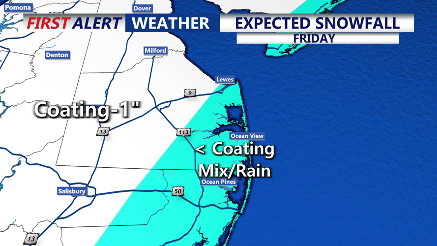
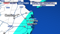
Forecast guidance continues to vary on how far north the precipitation shield will extend, with some models keeping the northern edge near or just north of the I-95 corridor, while others bring steadier snow over all of Delmarva. At this time, up to one inch of accumulation is possible, with the best chance west of Route 13. Coating or less from 113 to the coast.

Light accumulations, less than a coasting at the beaches, coating to an inch from Route 13 on points west.
Most precipitation will taper off Friday night as the system moves offshore, though lingering pockets of light snow or drizzle may persist near the coast. A shallow warm layer aloft could introduce isolated freezing drizzle in spots, but confidence remains low and no ice accumulation is currently forecast.
High pressure builds in on Saturday with partly to mostly cloudy skies. Temperatures will remain below normal, with highs ranging from the mid-40s and lows mainly in the 20s.
Another cold front arrives late Sunday with limited moisture, bringing only a low chance of a stray rain or snow shower. Reinforcing cold air follows, and Monday is shaping up to be the coldest day of the stretch. Lows Monday night are forecast to drop into the teens.
Temperatures stay below average through midweek. A clipper-type system may move through Tuesday night, bringing a 20–30% chance of light snow, mainly across northern Delmarva. Confidence in this system’s strength and track remains low, but colder-than-normal temperatures are expected to persist into Wednesday.
