


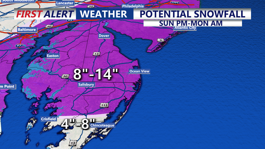
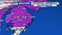

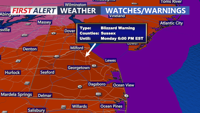


DELMARVA- A Blizzard Warning is in effect for Sussex county and the rest of Delmarva beginning Sunday at 1 PM and continuing until 6 PM Monday.
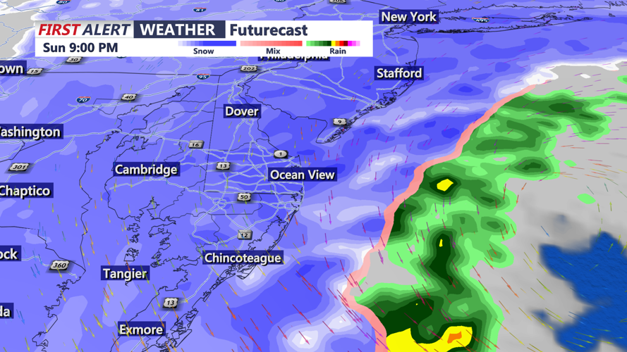
Precipitation in the form of rain will develop Sunday morning, then mix with and change to snow later in the day and continue into Monday, with blizzard conditions expected Sunday night into Monday morning. This means visibility will be less than a quarter mile at times with heavy snow and winds of 35 mph or greater, creating whiteout conditions.
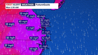
As low pressure rapidly develops off the North Carolina coast Sunday afternoon, the rain will change to snow later in the afternoon or evening and become heavy at times. Winds will also increase with gusts of 30 to 40 mph, with gusts to 50 mph at the coast at low pressure continues to deepen off our coast.
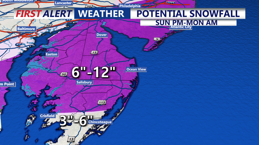
Snow, heavy at times, continues overnight Sunday into Monday morning, causing treacherous road conditions. At this point 6-12 inches of snow is expected with the storm, with locally higher amounts possible. Snowfall rates could exceed 2 inches per hour. Heavy wet snow sticking to powerlines and trees could cause power outages and downed trees.
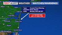
There will be significant coastal impact, with a Coastal Flood Warning for the Delaware coast Sunday evening through late Sunday night. One to two feet of inundation above ground level is possible in low-lying areas near shorelines and tidal waterways. Widespread roadway flooding is possible in vulnerable areas.
