


DELMARVA -- The new month and week starts with a pair of weak cold fronts moving through the region, bringing a breezy and slightly cooler feel to the area today.
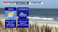
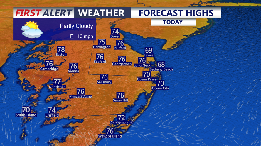
Skies will be partly cloudy through the day, with highs reaching the upper 60s to low 70s along the beaches. Inland communities can expect temperatures in the mid 70s, while portions of the Mid-Shore may climb into the upper 70s.

Mid to upper 70s, inland and Mid-Shore, upper 60s to low 70s at the beaches as an east wind develops gusting to 30 mph.
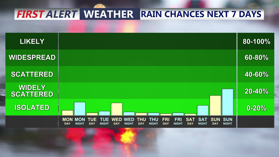
Winds will come out of the east-northeast and may gust between 25 and 30 mph at times, especially near the coast. The onshore flow, combined with a weak disturbance aloft, could be enough to spark a few isolated light showers across Delmarva. The best chance for a brief shower will be across Maryland and Virginia, though rainfall amounts are expected to be very light, generally only a trace to a few hundredths of an inch.

Can't rule out an isolated shower across MD & VA this afternoon, dry week as high pressure dominates.
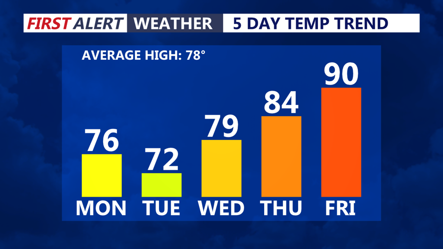
Skies will clear tonight, allowing temperatures to fall into the 40s and low 50s. It will feel seasonably chilly by early Tuesday morning.

Slightly cooler start to the week, warming to near 90 by Friday.
Looking ahead, high pressure will remain the dominant weather feature for Delmarva through the end of the week. An offshore low pressure system is expected to develop by mid-week, but current guidance keeps it well out over the Atlantic. Because of that, most, if not all, of Delmarva is expected to stay dry.
If the offshore low tracks a little closer to the coast, a northeast breeze could keep coastal areas slightly cooler around mid-week. Even then, dry weather is still expected to prevail.
Temperatures in the low 70s Tuesday, followed by a gradual warming trend through the end of the week. The 80s make a return Wednesday and Thursday. By Friday and Saturday, afternoon highs may climb back into the low 90s as high pressure shifts southeast and allows a much warmer air mass to build across the region.
There may be a chance for some precipitation by the weekend, but confidence remains low at this time.
